You are here: Home > Network List > TA - USArray Transportable Network (new EarthScope stations) Stations List
> Station W27A Bowe Ranch, Endee, NM, USA > Earthquake Result Viewer
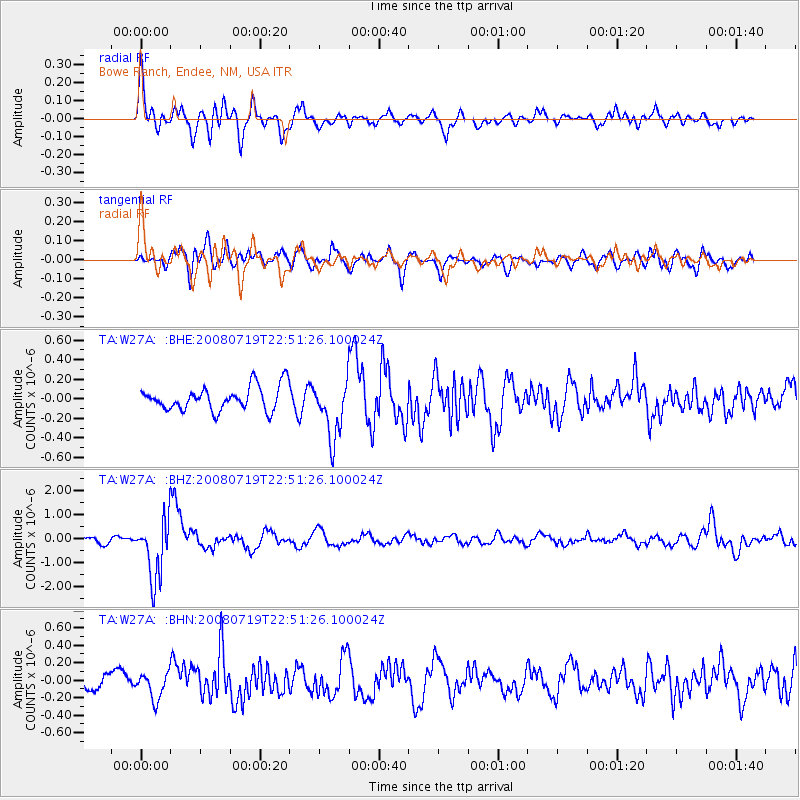
W27A Bowe Ranch, Endee, NM, USA - Earthquake Result Viewer
*The percent match for this event was below the threshold and hence no stack was calculated.
| Earthquake location: |
Fiji Islands Region |
| Earthquake latitude/longitude: |
-17.3/-177.3 |
| Earthquake time(UTC): |
2008/07/19 (201) 22:39:52 GMT |
| Earthquake Depth: |
391 km |
| Earthquake Magnitude: |
5.9 MB, 6.4 MW, 6.4 MW |
| Earthquake Catalog/Contributor: |
WHDF/NEIC |
|
| Network: |
TA USArray Transportable Network (new EarthScope stations) |
| Station: |
W27A Bowe Ranch, Endee, NM, USA |
| Lat/Lon: |
35.06 N/103.06 W |
| Elevation: |
1233 m |
|
| Distance: |
87.5 deg |
| Az: |
52.21 deg |
| Baz: |
246.946 deg |
| Ray Param: |
$rayparam |
*The percent match for this event was below the threshold and hence was not used in the summary stack. |
|
| Radial Match: |
73.94462 % |
| Radial Bump: |
400 |
| Transverse Match: |
66.59578 % |
| Transverse Bump: |
400 |
| SOD ConfigId: |
2504 |
| Insert Time: |
2010-03-06 18:38:05.989 +0000 |
| GWidth: |
2.5 |
| Max Bumps: |
400 |
| Tol: |
0.001 |
|
Signal To Noise
| Channel | StoN | STA | LTA |
| TA:W27A: :BHZ:20080719T22:51:26.100024Z | 9.883372 | 1.2436906E-6 | 1.2583666E-7 |
| TA:W27A: :BHN:20080719T22:51:26.100024Z | 1.1853728 | 1.4912892E-7 | 1.258076E-7 |
| TA:W27A: :BHE:20080719T22:51:26.100024Z | 2.4128778 | 2.9507368E-7 | 1.2229118E-7 |
| Arrivals |
| Ps | |
| PpPs | |
| PsPs/PpSs | |


