You are here: Home > Network List > TA - USArray Transportable Network (new EarthScope stations) Stations List
> Station B18K Kokolik River, AK, USA > Earthquake Result Viewer
B18K Kokolik River, AK, USA - Earthquake Result Viewer
*The percent match for this event was below the threshold and hence no stack was calculated.
| Earthquake location: |
Sichuan, China |
| Earthquake latitude/longitude: |
28.3/105.0 |
| Earthquake time(UTC): |
2018/12/16 (350) 04:46:11 GMT |
| Earthquake Depth: |
27 km |
| Earthquake Magnitude: |
5.4 Mww |
| Earthquake Catalog/Contributor: |
NEIC PDE/us |
|
| Network: |
TA USArray Transportable Network (new EarthScope stations) |
| Station: |
B18K Kokolik River, AK, USA |
| Lat/Lon: |
69.36 N/161.80 W |
| Elevation: |
222 m |
|
| Distance: |
65.0 deg |
| Az: |
22.993 deg |
| Baz: |
283.605 deg |
| Ray Param: |
$rayparam |
*The percent match for this event was below the threshold and hence was not used in the summary stack. |
|
| Radial Match: |
55.806305 % |
| Radial Bump: |
400 |
| Transverse Match: |
51.5571 % |
| Transverse Bump: |
400 |
| SOD ConfigId: |
13570011 |
| Insert Time: |
2019-05-02 01:38:08.743 +0000 |
| GWidth: |
2.5 |
| Max Bumps: |
400 |
| Tol: |
0.001 |
|
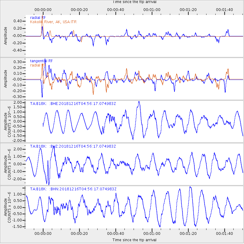
Signal To Noise
| Channel | StoN | STA | LTA |
| TA:B18K: :BHZ:20181216T04:56:17.074983Z | 2.0464947 | 1.5031892E-6 | 7.345189E-7 |
| TA:B18K: :BHN:20181216T04:56:17.074983Z | 0.90724766 | 6.4856863E-7 | 7.1487494E-7 |
| TA:B18K: :BHE:20181216T04:56:17.074983Z | 0.9770331 | 7.313765E-7 | 7.4856877E-7 |
| Arrivals |
| Ps | |
| PpPs | |
| PsPs/PpSs | |


