You are here: Home > Network List > TA - USArray Transportable Network (new EarthScope stations) Stations List
> Station H16K Elim, AK, USA > Earthquake Result Viewer
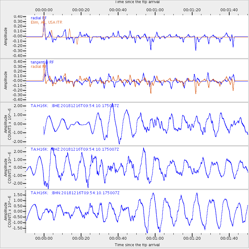
H16K Elim, AK, USA - Earthquake Result Viewer
*The percent match for this event was below the threshold and hence no stack was calculated.
| Earthquake location: |
Irian Jaya, Indonesia |
| Earthquake latitude/longitude: |
-3.9/140.3 |
| Earthquake time(UTC): |
2018/12/16 (350) 09:42:37 GMT |
| Earthquake Depth: |
61 km |
| Earthquake Magnitude: |
6.1 Mww |
| Earthquake Catalog/Contributor: |
NEIC PDE/us |
|
| Network: |
TA USArray Transportable Network (new EarthScope stations) |
| Station: |
H16K Elim, AK, USA |
| Lat/Lon: |
64.64 N/162.24 W |
| Elevation: |
216 m |
|
| Distance: |
80.2 deg |
| Az: |
21.626 deg |
| Baz: |
238.622 deg |
| Ray Param: |
$rayparam |
*The percent match for this event was below the threshold and hence was not used in the summary stack. |
|
| Radial Match: |
45.797276 % |
| Radial Bump: |
319 |
| Transverse Match: |
74.91454 % |
| Transverse Bump: |
400 |
| SOD ConfigId: |
13570011 |
| Insert Time: |
2019-05-02 01:42:44.412 +0000 |
| GWidth: |
2.5 |
| Max Bumps: |
400 |
| Tol: |
0.001 |
|
Signal To Noise
| Channel | StoN | STA | LTA |
| TA:H16K: :BHZ:20181216T09:54:10.175007Z | 4.4233885 | 1.8428927E-6 | 4.1662466E-7 |
| TA:H16K: :BHN:20181216T09:54:10.175007Z | 0.27303705 | 1.5923611E-7 | 5.832033E-7 |
| TA:H16K: :BHE:20181216T09:54:10.175007Z | 2.585607 | 1.1189211E-6 | 4.3274986E-7 |
| Arrivals |
| Ps | |
| PpPs | |
| PsPs/PpSs | |


