You are here: Home > Network List > TS - TERRAscope (Southern California Seismic Network) Stations List
> Station BAR Barrett Dam, California, USA > Earthquake Result Viewer
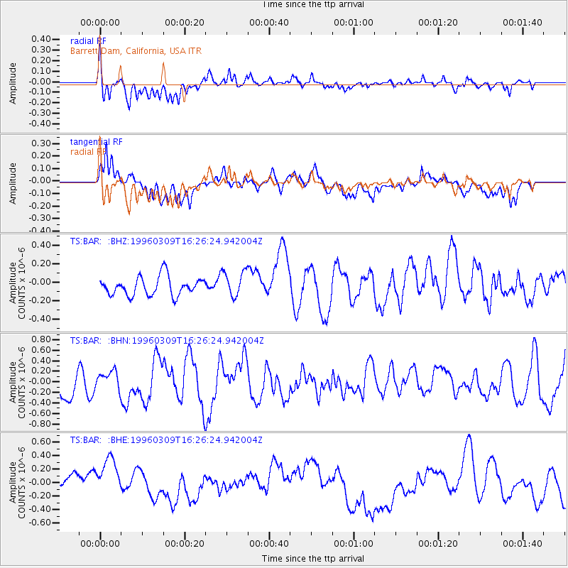
BAR Barrett Dam, California, USA - Earthquake Result Viewer
*The percent match for this event was below the threshold and hence no stack was calculated.
| Earthquake location: |
East Of Kuril Islands |
| Earthquake latitude/longitude: |
43.4/148.0 |
| Earthquake time(UTC): |
1996/03/09 (069) 16:15:36 GMT |
| Earthquake Depth: |
33 km |
| Earthquake Magnitude: |
5.6 MB, 5.9 MS, 6.1 UNKNOWN, 5.5 MS |
| Earthquake Catalog/Contributor: |
WHDF/NEIC |
|
| Network: |
TS TERRAscope (Southern California Seismic Network) |
| Station: |
BAR Barrett Dam, California, USA |
| Lat/Lon: |
32.68 N/116.67 W |
| Elevation: |
548 m |
|
| Distance: |
71.9 deg |
| Az: |
62.075 deg |
| Baz: |
310.242 deg |
| Ray Param: |
$rayparam |
*The percent match for this event was below the threshold and hence was not used in the summary stack. |
|
| Radial Match: |
68.01105 % |
| Radial Bump: |
400 |
| Transverse Match: |
63.022064 % |
| Transverse Bump: |
400 |
| SOD ConfigId: |
4480 |
| Insert Time: |
2010-02-26 14:01:50.344 +0000 |
| GWidth: |
2.5 |
| Max Bumps: |
400 |
| Tol: |
0.001 |
|
Signal To Noise
| Channel | StoN | STA | LTA |
| TS:BAR: :BHN:19960309T16:26:24.942004Z | 0.80965644 | 1.8275244E-7 | 2.2571604E-7 |
| TS:BAR: :BHE:19960309T16:26:24.942004Z | 2.8284397 | 3.6609987E-7 | 1.2943526E-7 |
| TS:BAR: :BHZ:19960309T16:26:24.942004Z | 1.3653771 | 1.3710874E-7 | 1.0041822E-7 |
| Arrivals |
| Ps | |
| PpPs | |
| PsPs/PpSs | |


