You are here: Home > Network List > TA - USArray Transportable Network (new EarthScope stations) Stations List
> Station V26A Tequesquite Ranch, Mosquero, NM, USA > Earthquake Result Viewer
V26A Tequesquite Ranch, Mosquero, NM, USA - Earthquake Result Viewer

| Earthquake location: |
Tonga Islands |
| Earthquake latitude/longitude: |
-16.3/-173.5 |
| Earthquake time(UTC): |
2009/10/02 (275) 01:07:39 GMT |
| Earthquake Depth: |
8.0 km |
| Earthquake Magnitude: |
6.1 MB, 6.0 MS, 6.1 MW, 6.1 MW |
| Earthquake Catalog/Contributor: |
WHDF/NEIC |
|
| Network: |
TA USArray Transportable Network (new EarthScope stations) |
| Station: |
V26A Tequesquite Ranch, Mosquero, NM, USA |
| Lat/Lon: |
35.80 N/103.79 W |
| Elevation: |
1362 m |
|
| Distance: |
83.8 deg |
| Az: |
50.076 deg |
| Baz: |
244.923 deg |
| Ray Param: |
0.045943137 |
| Estimated Moho Depth: |
14.5 km |
| Estimated Crust Vp/Vs: |
1.60 |
| Assumed Crust Vp: |
6.242 km/s |
| Estimated Crust Vs: |
3.901 km/s |
| Estimated Crust Poisson's Ratio: |
0.18 |
|
| Radial Match: |
83.917015 % |
| Radial Bump: |
400 |
| Transverse Match: |
73.8453 % |
| Transverse Bump: |
400 |
| SOD ConfigId: |
2622 |
| Insert Time: |
2010-03-06 18:40:21.751 +0000 |
| GWidth: |
2.5 |
| Max Bumps: |
400 |
| Tol: |
0.001 |
|
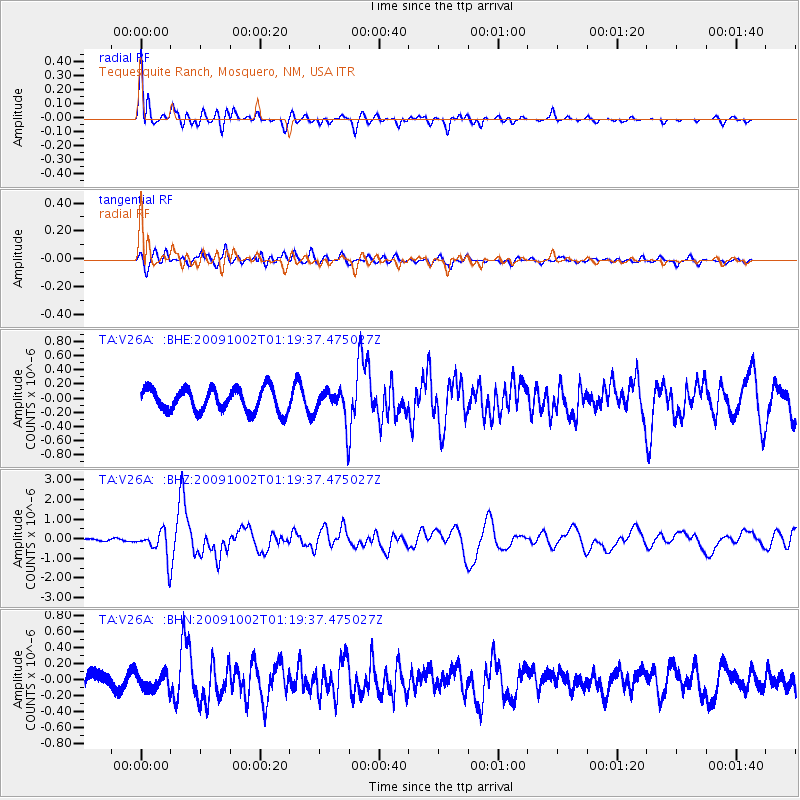
Signal To Noise
| Channel | StoN | STA | LTA |
| TA:V26A: :BHZ:20091002T01:19:37.475027Z | 4.21315 | 6.964881E-7 | 1.6531291E-7 |
| TA:V26A: :BHN:20091002T01:19:37.475027Z | 0.8686198 | 1.0561446E-7 | 1.2158883E-7 |
| TA:V26A: :BHE:20091002T01:19:37.475027Z | 1.4531541 | 2.3119244E-7 | 1.59097E-7 |
| Arrivals |
| Ps | 1.4 SECOND |
| PpPs | 5.9 SECOND |
| PsPs/PpSs | 7.3 SECOND |


