You are here: Home > Network List > TA - USArray Transportable Network (new EarthScope stations) Stations List
> Station D25K Kavik River, AK, USA > Earthquake Result Viewer
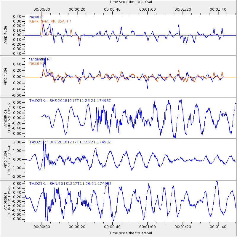
D25K Kavik River, AK, USA - Earthquake Result Viewer
*The percent match for this event was below the threshold and hence no stack was calculated.
| Earthquake location: |
New Britain Region, P.N.G. |
| Earthquake latitude/longitude: |
-5.0/152.3 |
| Earthquake time(UTC): |
2018/12/17 (351) 11:14:23 GMT |
| Earthquake Depth: |
60 km |
| Earthquake Magnitude: |
5.5 mb |
| Earthquake Catalog/Contributor: |
NEIC PDE/us |
|
| Network: |
TA USArray Transportable Network (new EarthScope stations) |
| Station: |
D25K Kavik River, AK, USA |
| Lat/Lon: |
69.32 N/146.38 W |
| Elevation: |
770 m |
|
| Distance: |
84.9 deg |
| Az: |
18.227 deg |
| Baz: |
241.309 deg |
| Ray Param: |
$rayparam |
*The percent match for this event was below the threshold and hence was not used in the summary stack. |
|
| Radial Match: |
61.259274 % |
| Radial Bump: |
400 |
| Transverse Match: |
83.687904 % |
| Transverse Bump: |
400 |
| SOD ConfigId: |
13570011 |
| Insert Time: |
2019-05-02 01:56:18.542 +0000 |
| GWidth: |
2.5 |
| Max Bumps: |
400 |
| Tol: |
0.001 |
|
Signal To Noise
| Channel | StoN | STA | LTA |
| TA:D25K: :BHZ:20181217T11:26:21.17498Z | 2.388763 | 8.2567936E-7 | 3.4565144E-7 |
| TA:D25K: :BHN:20181217T11:26:21.17498Z | 1.1395473 | 3.936102E-7 | 3.4540926E-7 |
| TA:D25K: :BHE:20181217T11:26:21.17498Z | 1.0794873 | 2.7528745E-7 | 2.5501686E-7 |
| Arrivals |
| Ps | |
| PpPs | |
| PsPs/PpSs | |


