You are here: Home > Network List > AZ - ANZA Regional Network Stations List
> Station LVA2 AZ.LVA2 > Earthquake Result Viewer
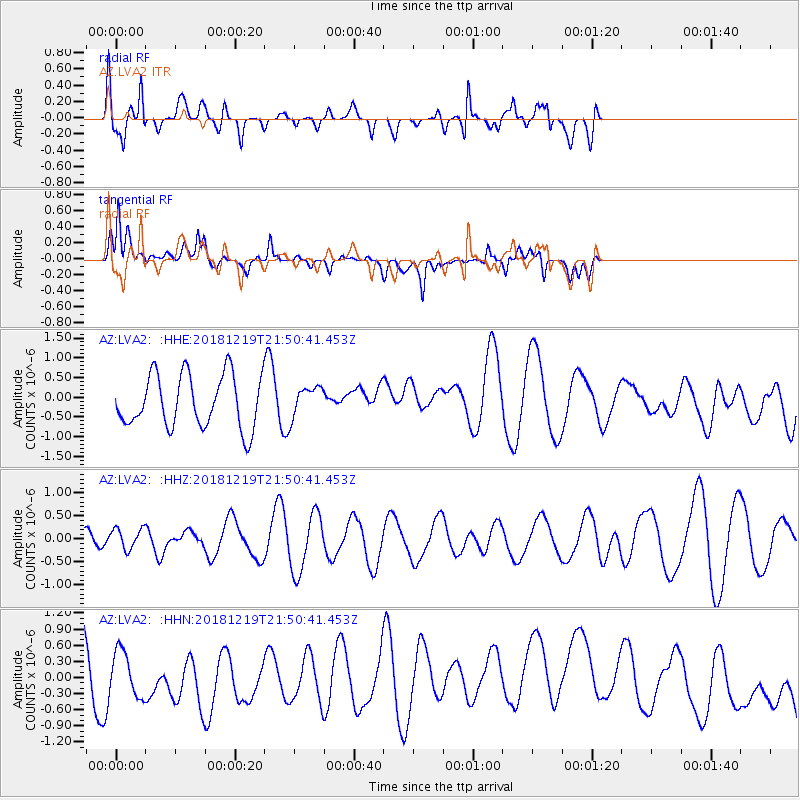
LVA2 AZ.LVA2 - Earthquake Result Viewer
*The percent match for this event was below the threshold and hence no stack was calculated.
| Earthquake location: |
New Britain Region, P.N.G. |
| Earthquake latitude/longitude: |
-6.1/149.8 |
| Earthquake time(UTC): |
2018/12/19 (353) 21:37:45 GMT |
| Earthquake Depth: |
8.7 km |
| Earthquake Magnitude: |
5.7 Mww |
| Earthquake Catalog/Contributor: |
NEIC PDE/us |
|
| Network: |
AZ ANZA Regional Network |
| Station: |
LVA2 AZ.LVA2 |
| Lat/Lon: |
33.35 N/116.56 W |
| Elevation: |
1435 m |
|
| Distance: |
96.3 deg |
| Az: |
57.189 deg |
| Baz: |
266.86 deg |
| Ray Param: |
$rayparam |
*The percent match for this event was below the threshold and hence was not used in the summary stack. |
|
| Radial Match: |
61.481983 % |
| Radial Bump: |
400 |
| Transverse Match: |
57.570328 % |
| Transverse Bump: |
400 |
| SOD ConfigId: |
13570011 |
| Insert Time: |
2019-05-02 02:06:55.364 +0000 |
| GWidth: |
2.5 |
| Max Bumps: |
400 |
| Tol: |
0.001 |
|
Signal To Noise
| Channel | StoN | STA | LTA |
| AZ:LVA2: :HHZ:20181219T21:50:41.453Z | 0.5801145 | 2.2787675E-7 | 3.9281343E-7 |
| AZ:LVA2: :HHN:20181219T21:50:41.453Z | 0.6541005 | 4.1692155E-7 | 6.373968E-7 |
| AZ:LVA2: :HHE:20181219T21:50:41.453Z | 0.34265456 | 2.4628778E-7 | 7.1876406E-7 |
| Arrivals |
| Ps | |
| PpPs | |
| PsPs/PpSs | |


