You are here: Home > Network List > IU - Global Seismograph Network (GSN - IRIS/USGS) Stations List
> Station JOHN Johnston Island, USA > Earthquake Result Viewer
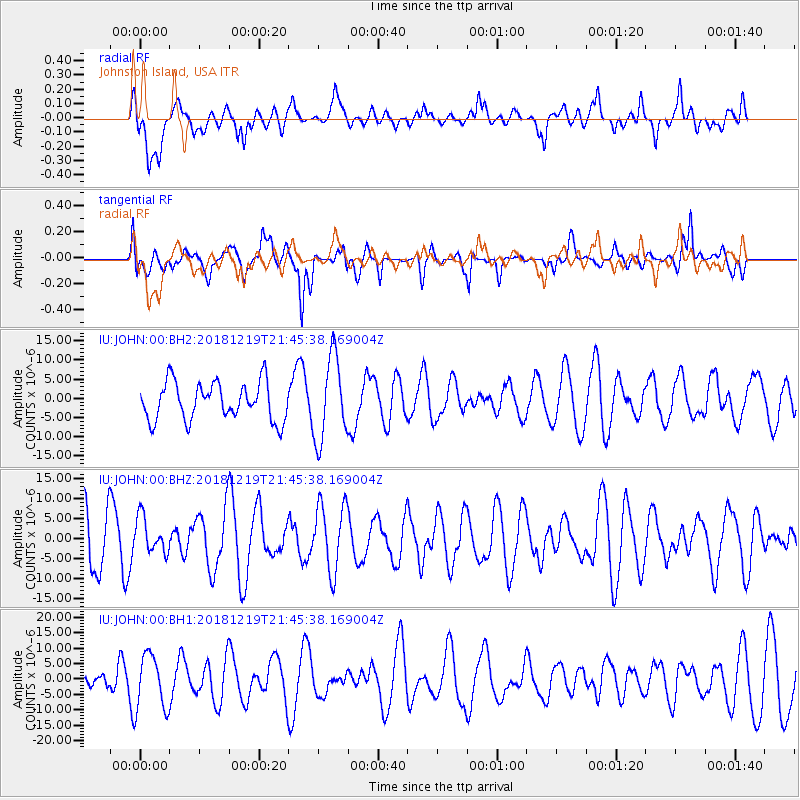
JOHN Johnston Island, USA - Earthquake Result Viewer
*The percent match for this event was below the threshold and hence no stack was calculated.
| Earthquake location: |
New Britain Region, P.N.G. |
| Earthquake latitude/longitude: |
-6.1/149.8 |
| Earthquake time(UTC): |
2018/12/19 (353) 21:37:45 GMT |
| Earthquake Depth: |
8.7 km |
| Earthquake Magnitude: |
5.7 Mww |
| Earthquake Catalog/Contributor: |
NEIC PDE/us |
|
| Network: |
IU Global Seismograph Network (GSN - IRIS/USGS) |
| Station: |
JOHN Johnston Island, USA |
| Lat/Lon: |
16.73 N/169.53 W |
| Elevation: |
2.0 m |
|
| Distance: |
46.1 deg |
| Az: |
59.913 deg |
| Baz: |
243.89 deg |
| Ray Param: |
$rayparam |
*The percent match for this event was below the threshold and hence was not used in the summary stack. |
|
| Radial Match: |
57.78765 % |
| Radial Bump: |
400 |
| Transverse Match: |
69.18011 % |
| Transverse Bump: |
400 |
| SOD ConfigId: |
13570011 |
| Insert Time: |
2019-05-02 02:08:35.834 +0000 |
| GWidth: |
2.5 |
| Max Bumps: |
400 |
| Tol: |
0.001 |
|
Signal To Noise
| Channel | StoN | STA | LTA |
| IU:JOHN:00:BHZ:20181219T21:45:38.169004Z | 0.5890192 | 4.6039904E-6 | 7.8163675E-6 |
| IU:JOHN:00:BH1:20181219T21:45:38.169004Z | 2.7302642 | 8.846457E-6 | 3.240147E-6 |
| IU:JOHN:00:BH2:20181219T21:45:38.169004Z | 2.0606875 | 1.0367383E-5 | 5.031031E-6 |
| Arrivals |
| Ps | |
| PpPs | |
| PsPs/PpSs | |


