You are here: Home > Network List > TA - USArray Transportable Network (new EarthScope stations) Stations List
> Station F21K Alatna River, AK, USA > Earthquake Result Viewer
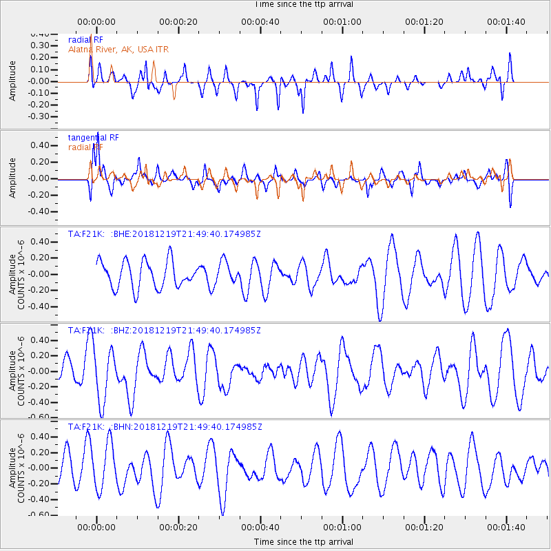
F21K Alatna River, AK, USA - Earthquake Result Viewer
*The percent match for this event was below the threshold and hence no stack was calculated.
| Earthquake location: |
New Britain Region, P.N.G. |
| Earthquake latitude/longitude: |
-6.1/149.8 |
| Earthquake time(UTC): |
2018/12/19 (353) 21:37:45 GMT |
| Earthquake Depth: |
8.7 km |
| Earthquake Magnitude: |
5.7 Mww |
| Earthquake Catalog/Contributor: |
NEIC PDE/us |
|
| Network: |
TA USArray Transportable Network (new EarthScope stations) |
| Station: |
F21K Alatna River, AK, USA |
| Lat/Lon: |
67.22 N/153.48 W |
| Elevation: |
597 m |
|
| Distance: |
83.4 deg |
| Az: |
19.119 deg |
| Baz: |
236.768 deg |
| Ray Param: |
$rayparam |
*The percent match for this event was below the threshold and hence was not used in the summary stack. |
|
| Radial Match: |
56.02813 % |
| Radial Bump: |
336 |
| Transverse Match: |
64.36484 % |
| Transverse Bump: |
400 |
| SOD ConfigId: |
13570011 |
| Insert Time: |
2019-05-02 02:09:59.298 +0000 |
| GWidth: |
2.5 |
| Max Bumps: |
400 |
| Tol: |
0.001 |
|
Signal To Noise
| Channel | StoN | STA | LTA |
| TA:F21K: :BHZ:20181219T21:49:40.174985Z | 1.7634393 | 3.3690583E-7 | 1.9105042E-7 |
| TA:F21K: :BHN:20181219T21:49:40.174985Z | 1.393966 | 2.915809E-7 | 2.0917362E-7 |
| TA:F21K: :BHE:20181219T21:49:40.174985Z | 0.9839279 | 1.5640752E-7 | 1.5896238E-7 |
| Arrivals |
| Ps | |
| PpPs | |
| PsPs/PpSs | |


