You are here: Home > Network List > TA - USArray Transportable Network (new EarthScope stations) Stations List
> Station G21K Allakaket, AK, USA > Earthquake Result Viewer
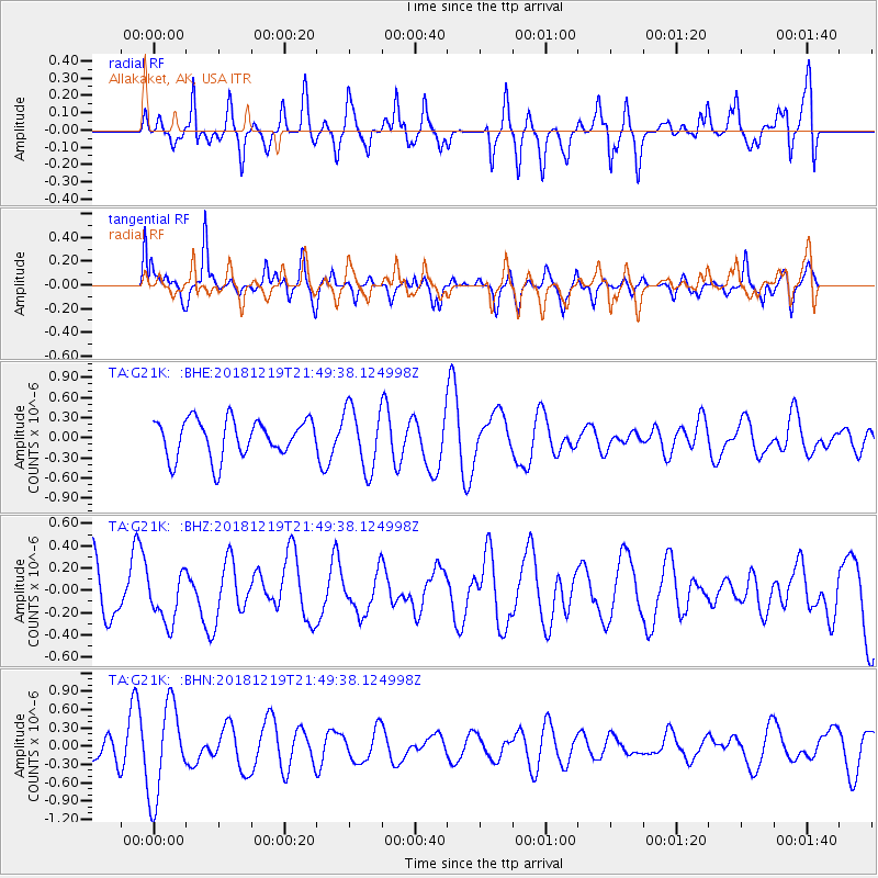
G21K Allakaket, AK, USA - Earthquake Result Viewer
*The percent match for this event was below the threshold and hence no stack was calculated.
| Earthquake location: |
New Britain Region, P.N.G. |
| Earthquake latitude/longitude: |
-6.1/149.8 |
| Earthquake time(UTC): |
2018/12/19 (353) 21:37:45 GMT |
| Earthquake Depth: |
8.7 km |
| Earthquake Magnitude: |
5.7 Mww |
| Earthquake Catalog/Contributor: |
NEIC PDE/us |
|
| Network: |
TA USArray Transportable Network (new EarthScope stations) |
| Station: |
G21K Allakaket, AK, USA |
| Lat/Lon: |
66.52 N/153.51 W |
| Elevation: |
446 m |
|
| Distance: |
83.0 deg |
| Az: |
19.712 deg |
| Baz: |
236.817 deg |
| Ray Param: |
$rayparam |
*The percent match for this event was below the threshold and hence was not used in the summary stack. |
|
| Radial Match: |
50.158947 % |
| Radial Bump: |
400 |
| Transverse Match: |
52.485065 % |
| Transverse Bump: |
389 |
| SOD ConfigId: |
13570011 |
| Insert Time: |
2019-05-02 02:10:02.597 +0000 |
| GWidth: |
2.5 |
| Max Bumps: |
400 |
| Tol: |
0.001 |
|
Signal To Noise
| Channel | StoN | STA | LTA |
| TA:G21K: :BHZ:20181219T21:49:38.124998Z | 1.074894 | 2.2627223E-7 | 2.1050657E-7 |
| TA:G21K: :BHN:20181219T21:49:38.124998Z | 2.5451703 | 7.600185E-7 | 2.9861206E-7 |
| TA:G21K: :BHE:20181219T21:49:38.124998Z | 1.6477145 | 4.7751934E-7 | 2.8980708E-7 |
| Arrivals |
| Ps | |
| PpPs | |
| PsPs/PpSs | |


