You are here: Home > Network List > AZ - ANZA Regional Network Stations List
> Station SMER AZ.SMER > Earthquake Result Viewer
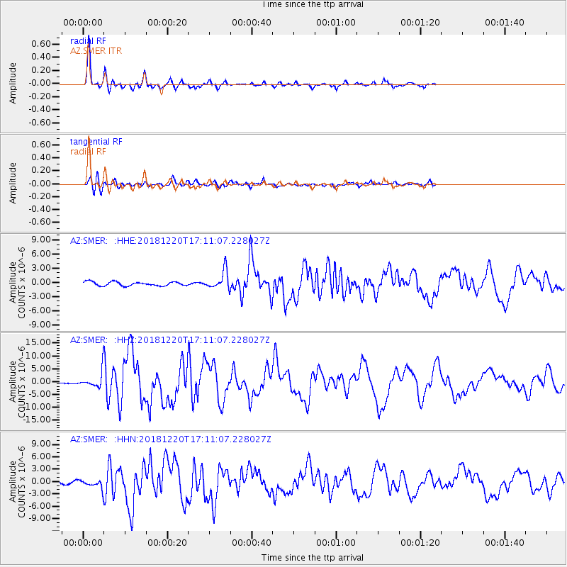
SMER AZ.SMER - Earthquake Result Viewer
*The percent match for this event was below the threshold and hence no stack was calculated.
| Earthquake location: |
Komandorskiye Ostrova Region |
| Earthquake latitude/longitude: |
54.8/164.8 |
| Earthquake time(UTC): |
2018/12/20 (354) 17:01:56 GMT |
| Earthquake Depth: |
33 km |
| Earthquake Magnitude: |
7.3 Mi |
| Earthquake Catalog/Contributor: |
NEIC PDE/pt |
|
| Network: |
AZ ANZA Regional Network |
| Station: |
SMER AZ.SMER |
| Lat/Lon: |
33.46 N/117.17 W |
| Elevation: |
355 m |
|
| Distance: |
56.8 deg |
| Az: |
77.882 deg |
| Baz: |
317.44 deg |
| Ray Param: |
$rayparam |
*The percent match for this event was below the threshold and hence was not used in the summary stack. |
|
| Radial Match: |
94.43691 % |
| Radial Bump: |
332 |
| Transverse Match: |
84.13132 % |
| Transverse Bump: |
400 |
| SOD ConfigId: |
13570011 |
| Insert Time: |
2019-05-02 02:12:43.105 +0000 |
| GWidth: |
2.5 |
| Max Bumps: |
400 |
| Tol: |
0.001 |
|
Signal To Noise
| Channel | StoN | STA | LTA |
| AZ:SMER: :HHZ:20181220T17:11:07.228027Z | 16.089693 | 3.6618583E-6 | 2.275903E-7 |
| AZ:SMER: :HHN:20181220T17:11:07.228027Z | 3.6775422 | 1.2099669E-6 | 3.2901508E-7 |
| AZ:SMER: :HHE:20181220T17:11:07.228027Z | 3.309333 | 1.4119854E-6 | 4.2666767E-7 |
| Arrivals |
| Ps | |
| PpPs | |
| PsPs/PpSs | |


