You are here: Home > Network List > CI - Caltech Regional Seismic Network Stations List
> Station BFS Mt Baldy Forest Station > Earthquake Result Viewer
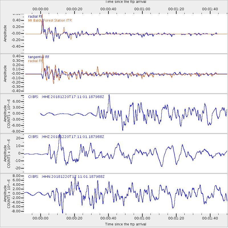
BFS Mt Baldy Forest Station - Earthquake Result Viewer
*The percent match for this event was below the threshold and hence no stack was calculated.
| Earthquake location: |
Komandorskiye Ostrova Region |
| Earthquake latitude/longitude: |
54.8/164.8 |
| Earthquake time(UTC): |
2018/12/20 (354) 17:01:56 GMT |
| Earthquake Depth: |
33 km |
| Earthquake Magnitude: |
7.3 Mi |
| Earthquake Catalog/Contributor: |
NEIC PDE/pt |
|
| Network: |
CI Caltech Regional Seismic Network |
| Station: |
BFS Mt Baldy Forest Station |
| Lat/Lon: |
34.24 N/117.66 W |
| Elevation: |
1312 m |
|
| Distance: |
55.9 deg |
| Az: |
77.604 deg |
| Baz: |
317.016 deg |
| Ray Param: |
$rayparam |
*The percent match for this event was below the threshold and hence was not used in the summary stack. |
|
| Radial Match: |
92.909744 % |
| Radial Bump: |
400 |
| Transverse Match: |
82.14476 % |
| Transverse Bump: |
400 |
| SOD ConfigId: |
13570011 |
| Insert Time: |
2019-05-02 02:13:51.986 +0000 |
| GWidth: |
2.5 |
| Max Bumps: |
400 |
| Tol: |
0.001 |
|
Signal To Noise
| Channel | StoN | STA | LTA |
| CI:BFS: :HHZ:20181220T17:11:01.187988Z | 4.289726 | 1.4982394E-6 | 3.4926228E-7 |
| CI:BFS: :HHN:20181220T17:11:01.187988Z | 0.74118894 | 4.572368E-7 | 6.1689644E-7 |
| CI:BFS: :HHE:20181220T17:11:01.187988Z | 1.7792757 | 6.043822E-7 | 3.3967876E-7 |
| Arrivals |
| Ps | |
| PpPs | |
| PsPs/PpSs | |


