You are here: Home > Network List > CI - Caltech Regional Seismic Network Stations List
> Station DAN Danby, California, USA > Earthquake Result Viewer
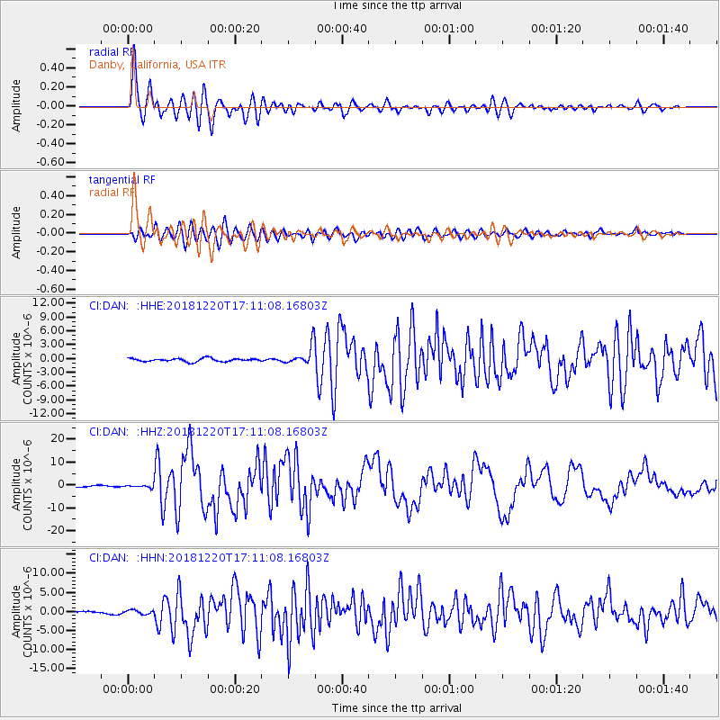
DAN Danby, California, USA - Earthquake Result Viewer
*The percent match for this event was below the threshold and hence no stack was calculated.
| Earthquake location: |
Komandorskiye Ostrova Region |
| Earthquake latitude/longitude: |
54.8/164.8 |
| Earthquake time(UTC): |
2018/12/20 (354) 17:01:56 GMT |
| Earthquake Depth: |
33 km |
| Earthquake Magnitude: |
7.3 Mi |
| Earthquake Catalog/Contributor: |
NEIC PDE/pt |
|
| Network: |
CI Caltech Regional Seismic Network |
| Station: |
DAN Danby, California, USA |
| Lat/Lon: |
34.64 N/115.38 W |
| Elevation: |
398 m |
|
| Distance: |
56.9 deg |
| Az: |
75.624 deg |
| Baz: |
317.202 deg |
| Ray Param: |
$rayparam |
*The percent match for this event was below the threshold and hence was not used in the summary stack. |
|
| Radial Match: |
94.55035 % |
| Radial Bump: |
400 |
| Transverse Match: |
81.71108 % |
| Transverse Bump: |
400 |
| SOD ConfigId: |
13570011 |
| Insert Time: |
2019-05-02 02:13:58.762 +0000 |
| GWidth: |
2.5 |
| Max Bumps: |
400 |
| Tol: |
0.001 |
|
Signal To Noise
| Channel | StoN | STA | LTA |
| CI:DAN: :HHZ:20181220T17:11:08.16803Z | 1.1604558 | 5.530484E-7 | 4.7657858E-7 |
| CI:DAN: :HHN:20181220T17:11:08.16803Z | 1.3702165 | 5.289141E-7 | 3.8600768E-7 |
| CI:DAN: :HHE:20181220T17:11:08.16803Z | 1.0571805 | 3.7755382E-7 | 3.571328E-7 |
| Arrivals |
| Ps | |
| PpPs | |
| PsPs/PpSs | |


