You are here: Home > Network List > CI - Caltech Regional Seismic Network Stations List
> Station MPM Manuel Prospect Mine, California, USA > Earthquake Result Viewer
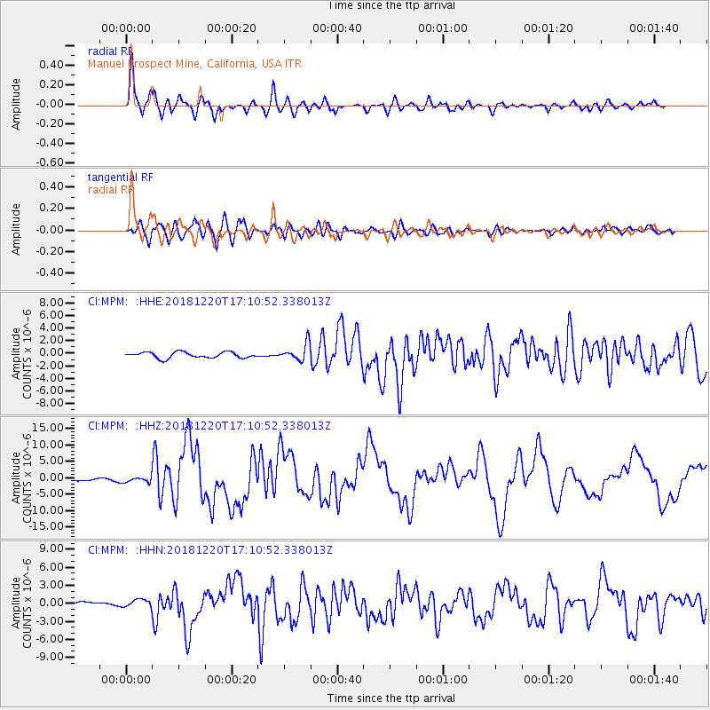
MPM Manuel Prospect Mine, California, USA - Earthquake Result Viewer
*The percent match for this event was below the threshold and hence no stack was calculated.
| Earthquake location: |
Komandorskiye Ostrova Region |
| Earthquake latitude/longitude: |
54.8/164.8 |
| Earthquake time(UTC): |
2018/12/20 (354) 17:01:56 GMT |
| Earthquake Depth: |
33 km |
| Earthquake Magnitude: |
7.3 Mi |
| Earthquake Catalog/Contributor: |
NEIC PDE/pt |
|
| Network: |
CI Caltech Regional Seismic Network |
| Station: |
MPM Manuel Prospect Mine, California, USA |
| Lat/Lon: |
36.06 N/117.49 W |
| Elevation: |
185 m |
|
| Distance: |
54.7 deg |
| Az: |
75.964 deg |
| Baz: |
316.179 deg |
| Ray Param: |
$rayparam |
*The percent match for this event was below the threshold and hence was not used in the summary stack. |
|
| Radial Match: |
89.42317 % |
| Radial Bump: |
400 |
| Transverse Match: |
81.669975 % |
| Transverse Bump: |
400 |
| SOD ConfigId: |
13570011 |
| Insert Time: |
2019-05-02 02:14:15.315 +0000 |
| GWidth: |
2.5 |
| Max Bumps: |
400 |
| Tol: |
0.001 |
|
Signal To Noise
| Channel | StoN | STA | LTA |
| CI:MPM: :HHZ:20181220T17:10:52.338013Z | 1.8804907 | 7.3040536E-7 | 3.884121E-7 |
| CI:MPM: :HHN:20181220T17:10:52.338013Z | 1.4815253 | 5.890263E-7 | 3.9758098E-7 |
| CI:MPM: :HHE:20181220T17:10:52.338013Z | 1.1029536 | 5.2131935E-7 | 4.7265755E-7 |
| Arrivals |
| Ps | |
| PpPs | |
| PsPs/PpSs | |


