You are here: Home > Network List > CI - Caltech Regional Seismic Network Stations List
> Station MPP McPhearson Peak > Earthquake Result Viewer
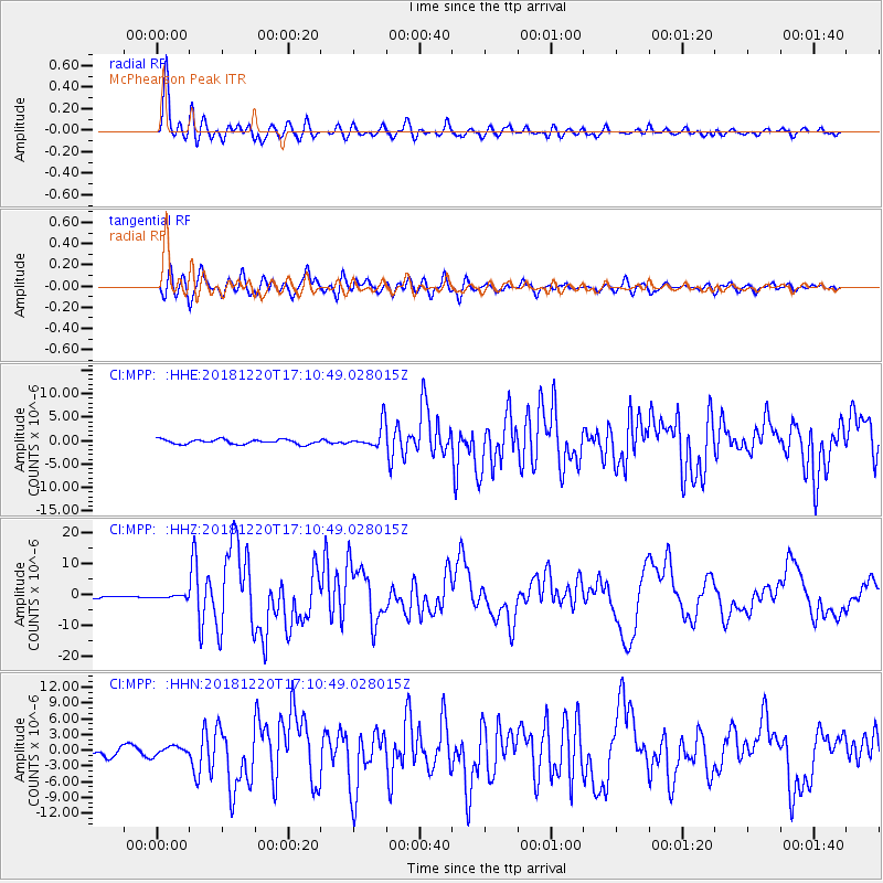
MPP McPhearson Peak - Earthquake Result Viewer
*The percent match for this event was below the threshold and hence no stack was calculated.
| Earthquake location: |
Komandorskiye Ostrova Region |
| Earthquake latitude/longitude: |
54.8/164.8 |
| Earthquake time(UTC): |
2018/12/20 (354) 17:01:56 GMT |
| Earthquake Depth: |
33 km |
| Earthquake Magnitude: |
7.3 Mi |
| Earthquake Catalog/Contributor: |
NEIC PDE/pt |
|
| Network: |
CI Caltech Regional Seismic Network |
| Station: |
MPP McPhearson Peak |
| Lat/Lon: |
34.89 N/119.81 W |
| Elevation: |
1739 m |
|
| Distance: |
54.2 deg |
| Az: |
78.641 deg |
| Baz: |
316.392 deg |
| Ray Param: |
$rayparam |
*The percent match for this event was below the threshold and hence was not used in the summary stack. |
|
| Radial Match: |
93.396645 % |
| Radial Bump: |
400 |
| Transverse Match: |
84.04685 % |
| Transverse Bump: |
400 |
| SOD ConfigId: |
13570011 |
| Insert Time: |
2019-05-02 02:14:15.749 +0000 |
| GWidth: |
2.5 |
| Max Bumps: |
400 |
| Tol: |
0.001 |
|
Signal To Noise
| Channel | StoN | STA | LTA |
| CI:MPP: :HHZ:20181220T17:10:49.028015Z | 0.46226025 | 4.506228E-7 | 9.748248E-7 |
| CI:MPP: :HHN:20181220T17:10:49.028015Z | 0.98812115 | 8.3783914E-7 | 8.479114E-7 |
| CI:MPP: :HHE:20181220T17:10:49.028015Z | 0.7872829 | 3.8644782E-7 | 4.908627E-7 |
| Arrivals |
| Ps | |
| PpPs | |
| PsPs/PpSs | |


