You are here: Home > Network List > GS - US Geological Survey Networks Stations List
> Station KAN10 Keim Farm > Earthquake Result Viewer
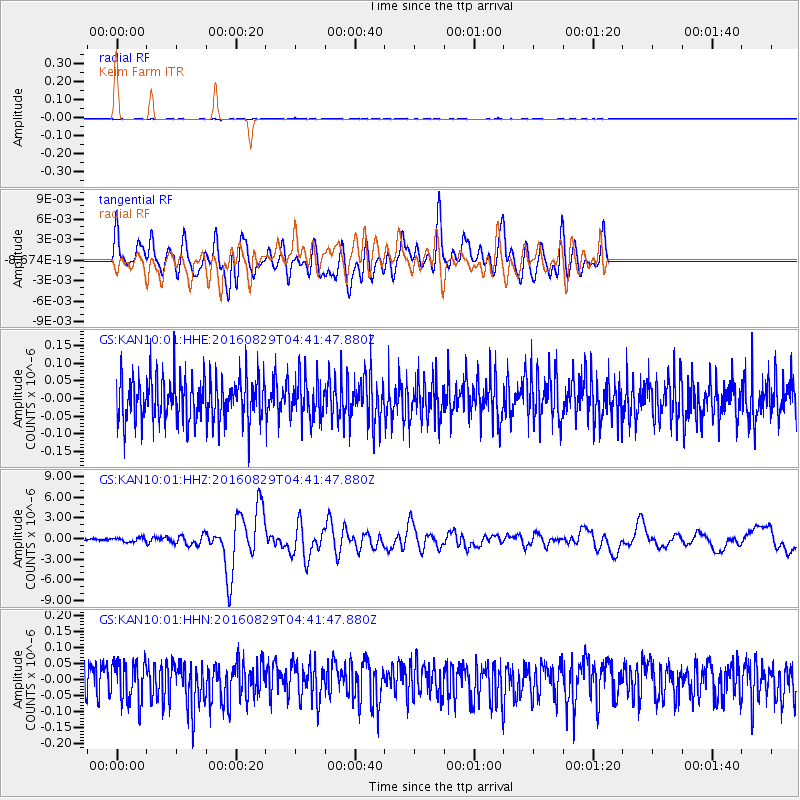
KAN10 Keim Farm - Earthquake Result Viewer
*The percent match for this event was below the threshold and hence no stack was calculated.
| Earthquake location: |
North Of Ascension Island |
| Earthquake latitude/longitude: |
-0.0/-17.8 |
| Earthquake time(UTC): |
2016/08/29 (242) 04:29:57 GMT |
| Earthquake Depth: |
10 km |
| Earthquake Magnitude: |
7.1 MWW, 7.1 MWC, 7.4 MI |
| Earthquake Catalog/Contributor: |
NEIC PDE/NEIC COMCAT |
|
| Network: |
GS US Geological Survey Networks |
| Station: |
KAN10 Keim Farm |
| Lat/Lon: |
37.12 N/98.10 W |
| Elevation: |
417 m |
|
| Distance: |
82.3 deg |
| Az: |
307.343 deg |
| Baz: |
95.924 deg |
| Ray Param: |
$rayparam |
*The percent match for this event was below the threshold and hence was not used in the summary stack. |
|
| Radial Match: |
42.999657 % |
| Radial Bump: |
400 |
| Transverse Match: |
49.71096 % |
| Transverse Bump: |
400 |
| SOD ConfigId: |
1634031 |
| Insert Time: |
2016-09-12 04:31:46.927 +0000 |
| GWidth: |
2.5 |
| Max Bumps: |
400 |
| Tol: |
0.001 |
|
Signal To Noise
| Channel | StoN | STA | LTA |
| GS:KAN10:01:HHZ:20160829T04:41:47.880Z | 2.3965318 | 3.08441E-7 | 1.2870306E-7 |
| GS:KAN10:01:HHN:20160829T04:41:47.880Z | 1.0219547 | 6.4902544E-8 | 6.3508246E-8 |
| GS:KAN10:01:HHE:20160829T04:41:47.880Z | 0.87112117 | 5.4431258E-8 | 6.248414E-8 |
| Arrivals |
| Ps | |
| PpPs | |
| PsPs/PpSs | |


