You are here: Home > Network List > IU - Global Seismograph Network (GSN - IRIS/USGS) Stations List
> Station SLBS Sierra la Laguna Baja California Sur, Mexico > Earthquake Result Viewer
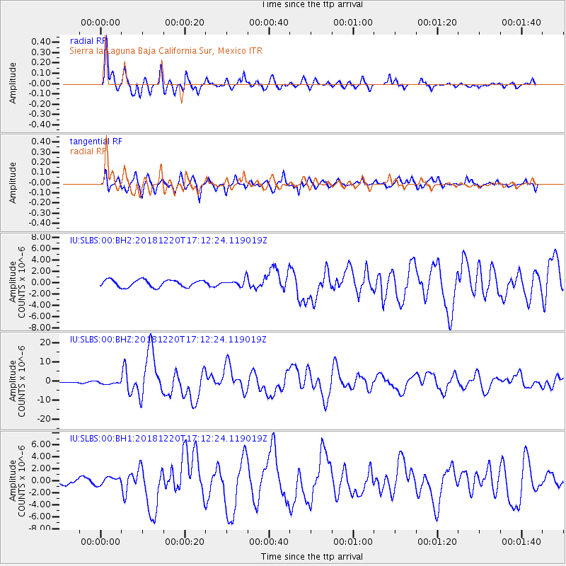
SLBS Sierra la Laguna Baja California Sur, Mexico - Earthquake Result Viewer
*The percent match for this event was below the threshold and hence no stack was calculated.
| Earthquake location: |
Komandorskiye Ostrova Region |
| Earthquake latitude/longitude: |
54.8/164.8 |
| Earthquake time(UTC): |
2018/12/20 (354) 17:01:56 GMT |
| Earthquake Depth: |
33 km |
| Earthquake Magnitude: |
7.3 Mi |
| Earthquake Catalog/Contributor: |
NEIC PDE/pt |
|
| Network: |
IU Global Seismograph Network (GSN - IRIS/USGS) |
| Station: |
SLBS Sierra la Laguna Baja California Sur, Mexico |
| Lat/Lon: |
23.69 N/109.94 W |
| Elevation: |
825 m |
|
| Distance: |
68.3 deg |
| Az: |
79.531 deg |
| Baz: |
321.659 deg |
| Ray Param: |
$rayparam |
*The percent match for this event was below the threshold and hence was not used in the summary stack. |
|
| Radial Match: |
93.2252 % |
| Radial Bump: |
400 |
| Transverse Match: |
86.55369 % |
| Transverse Bump: |
400 |
| SOD ConfigId: |
13570011 |
| Insert Time: |
2019-05-02 02:17:57.880 +0000 |
| GWidth: |
2.5 |
| Max Bumps: |
400 |
| Tol: |
0.001 |
|
Signal To Noise
| Channel | StoN | STA | LTA |
| IU:SLBS:00:BHZ:20181220T17:12:24.119019Z | 1.5373399 | 8.2352625E-7 | 5.3568266E-7 |
| IU:SLBS:00:BH1:20181220T17:12:24.119019Z | 1.246283 | 6.519183E-7 | 5.230901E-7 |
| IU:SLBS:00:BH2:20181220T17:12:24.119019Z | 0.4475617 | 2.8472098E-7 | 6.361603E-7 |
| Arrivals |
| Ps | |
| PpPs | |
| PsPs/PpSs | |


