You are here: Home > Network List > IW - Intermountain West Stations List
> Station PLID Pearl Lake, Idaho, USA > Earthquake Result Viewer
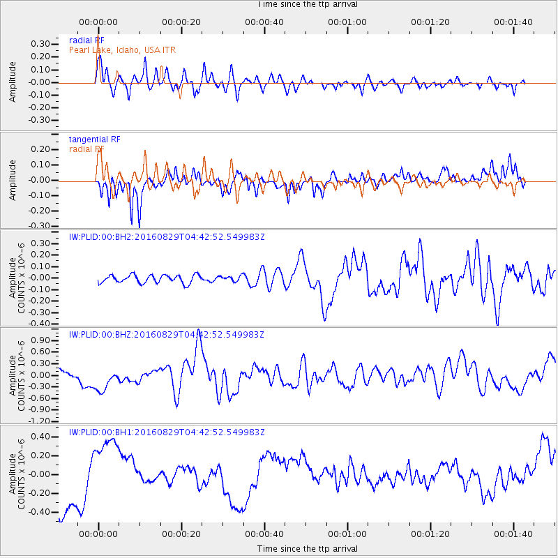
PLID Pearl Lake, Idaho, USA - Earthquake Result Viewer
*The percent match for this event was below the threshold and hence no stack was calculated.
| Earthquake location: |
North Of Ascension Island |
| Earthquake latitude/longitude: |
-0.0/-17.8 |
| Earthquake time(UTC): |
2016/08/29 (242) 04:29:57 GMT |
| Earthquake Depth: |
10 km |
| Earthquake Magnitude: |
7.1 MWW, 7.1 MWC, 7.4 MI |
| Earthquake Catalog/Contributor: |
NEIC PDE/NEIC COMCAT |
|
| Network: |
IW Intermountain West |
| Station: |
PLID Pearl Lake, Idaho, USA |
| Lat/Lon: |
45.09 N/116.00 W |
| Elevation: |
2164 m |
|
| Distance: |
95.8 deg |
| Az: |
315.184 deg |
| Baz: |
84.246 deg |
| Ray Param: |
$rayparam |
*The percent match for this event was below the threshold and hence was not used in the summary stack. |
|
| Radial Match: |
75.75424 % |
| Radial Bump: |
400 |
| Transverse Match: |
67.616684 % |
| Transverse Bump: |
356 |
| SOD ConfigId: |
1634031 |
| Insert Time: |
2016-09-12 04:33:14.081 +0000 |
| GWidth: |
2.5 |
| Max Bumps: |
400 |
| Tol: |
0.001 |
|
Signal To Noise
| Channel | StoN | STA | LTA |
| IW:PLID:00:BHZ:20160829T04:42:52.549983Z | 2.092865 | 3.5168406E-7 | 1.6803955E-7 |
| IW:PLID:00:BH1:20160829T04:42:52.549983Z | 1.3565555 | 3.5292686E-7 | 2.6016397E-7 |
| IW:PLID:00:BH2:20160829T04:42:52.549983Z | 0.6753631 | 2.3631618E-8 | 3.499098E-8 |
| Arrivals |
| Ps | |
| PpPs | |
| PsPs/PpSs | |


