V19A Window Rock, AZ, USA - Earthquake Result Viewer
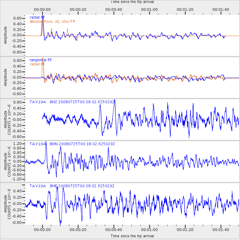
Earthquake location: Rat Islands, Aleutian Islands
Earthquake latitude/longitude: 51.3/179.0
Earthquake time(UTC): 2008/07/25 (207) 00:29:22 GMT
Earthquake Depth: 21 km
Earthquake Magnitude: 5.7 MB, 5.5 MS, 5.9 MW, 5.9 MW
Earthquake Catalog/Contributor: WHDF/NEIC
Network: TA USArray Transportable Network (new EarthScope stations)
Station: V19A Window Rock, AZ, USA
Lat/Lon: 35.71 N/109.05 W
Elevation: 2082 m
Distance: 52.4 deg
Az: 77.677 deg
Baz: 311.06 deg
Ray Param: 0.066769
Estimated Moho Depth: 31.5 km
Estimated Crust Vp/Vs: 2.00
Assumed Crust Vp: 6.496 km/s
Estimated Crust Vs: 3.252 km/s
Estimated Crust Poisson's Ratio: 0.33
Radial Match: 81.806625 %
Radial Bump: 400
Transverse Match: 60.841476 %
Transverse Bump: 400
SOD ConfigId: 2504
Insert Time: 2010-03-06 18:44:45.669 +0000
GWidth: 2.5
Max Bumps: 400
Tol: 0.001

Signal To Noise

ChannelStoNSTALTA
TA:V19A: :BHN:20080725T00:38:02.625029Z6.0057695.280267E-78.7919915E-8
TA:V19A: :BHE:20080725T00:38:02.625029Z2.80557372.3543703E-78.391761E-8
TA:V19A: :BHZ:20080725T00:38:02.625029Z3.43026833.0130468E-78.7837066E-8
Arrivals
Ps5.1 SECOND
PpPs14 SECOND
PsPs/PpSs19 SECOND