V19A Window Rock, AZ, USA - Earthquake Result Viewer
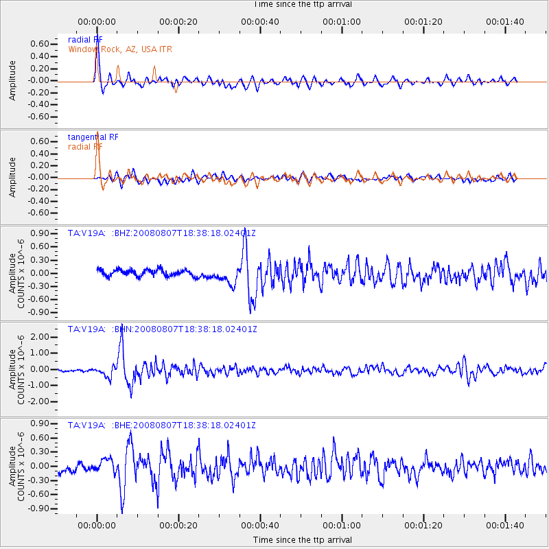
Earthquake location: Andreanof Islands, Aleutian Is.
Earthquake latitude/longitude: 52.2/-175.7
Earthquake time(UTC): 2008/08/07 (220) 18:30:03 GMT
Earthquake Depth: 12 km
Earthquake Magnitude: 5.6 MB, 5.5 MS, 5.8 MW, 5.8 MW
Earthquake Catalog/Contributor: WHDF/NEIC
Network: TA USArray Transportable Network (new EarthScope stations)
Station: V19A Window Rock, AZ, USA
Lat/Lon: 35.71 N/109.05 W
Elevation: 2082 m
Distance: 48.9 deg
Az: 82.138 deg
Baz: 311.464 deg
Ray Param: 0.06902404
Estimated Moho Depth: 17.5 km
Estimated Crust Vp/Vs: 2.10
Assumed Crust Vp: 6.496 km/s
Estimated Crust Vs: 3.097 km/s
Estimated Crust Poisson's Ratio: 0.35
Radial Match: 84.966866 %
Radial Bump: 400
Transverse Match: 70.43929 %
Transverse Bump: 400
SOD ConfigId: 2504
Insert Time: 2010-03-06 18:44:47.768 +0000
GWidth: 2.5
Max Bumps: 400
Tol: 0.001

Signal To Noise

ChannelStoNSTALTA
TA:V19A: :BHN:20080807T18:38:18.02401Z4.8739093.1785325E-76.521526E-8
TA:V19A: :BHE:20080807T18:38:18.02401Z1.92343661.4439809E-77.507296E-8
TA:V19A: :BHZ:20080807T18:38:18.02401Z2.84276682.0433019E-77.1877224E-8
Arrivals
Ps3.1 SECOND
PpPs7.9 SECOND
PsPs/PpSs11 SECOND