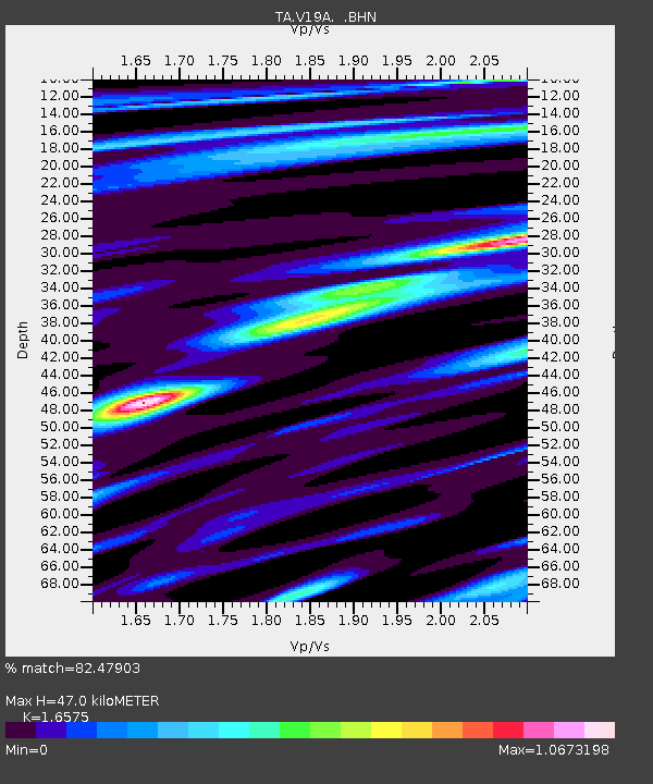
V19A Window Rock, AZ, USA - Earthquake Result Viewer
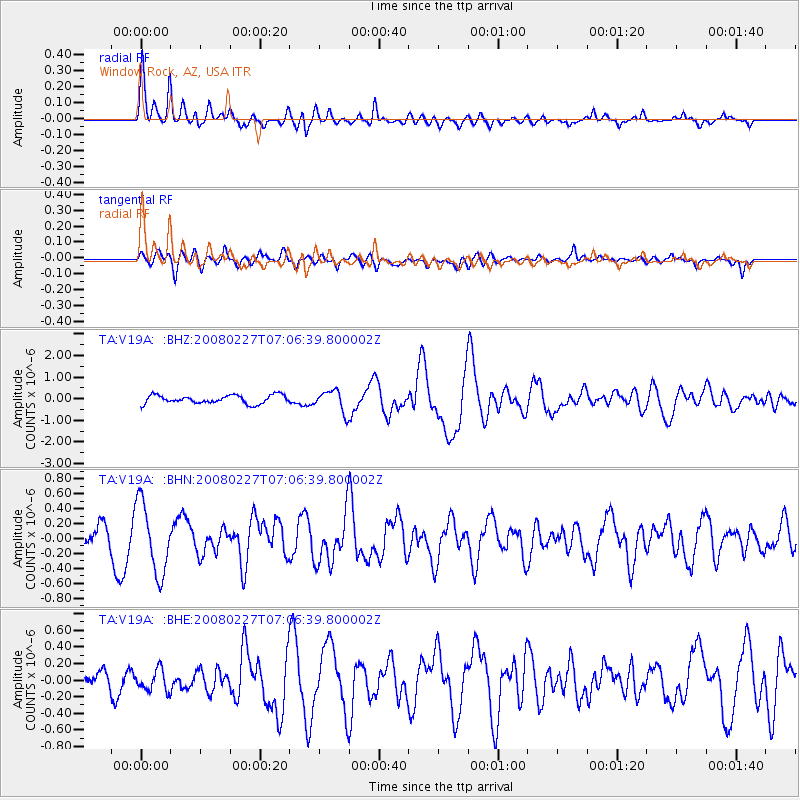
Earthquake location: Bonin Islands, Japan Region
Earthquake latitude/longitude: 26.8/142.4
Earthquake time(UTC): 2008/02/27 (058) 06:54:20 GMT
Earthquake Depth: 15 km
Earthquake Magnitude: 5.8 MB, 6.1 MS, 6.2 MW, 6.2 MW
Earthquake Catalog/Contributor: WHDF/NEIC
Network: TA USArray Transportable Network (new EarthScope stations)
Station: V19A Window Rock, AZ, USA
Lat/Lon: 35.71 N/109.05 W
Elevation: 2082 m
Distance: 88.3 deg
Az: 50.534 deg
Baz: 302.028 deg
Ray Param: 0.042687073
Estimated Moho Depth: 47.0 km
Estimated Crust Vp/Vs: 1.66
Assumed Crust Vp: 6.496 km/s
Estimated Crust Vs: 3.919 km/s
Estimated Crust Poisson's Ratio: 0.21
Radial Match: 82.47903 %
Radial Bump: 400
Transverse Match: 51.519173 %
Transverse Bump: 400
SOD ConfigId: 2564
Insert Time: 2010-03-06 18:45:08.136 +0000
GWidth: 2.5
Max Bumps: 400
Tol: 0.001

Signal To Noise

ChannelStoNSTALTA
TA:V19A: :BHN:20080227T07:06:39.800002Z2.63378764.7444306E-71.8013718E-7
TA:V19A: :BHE:20080227T07:06:39.800002Z1.56698471.3368226E-78.531178E-8
TA:V19A: :BHZ:20080227T07:06:39.800002Z2.60603645.0312815E-71.9306258E-7
Arrivals
Ps4.9 SECOND
PpPs19 SECOND
PsPs/PpSs24 SECOND