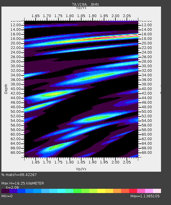
V19A Window Rock, AZ, USA - Earthquake Result Viewer
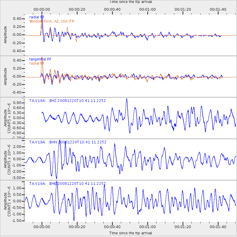
Earthquake location: Off East Coast Of Honshu, Japan
Earthquake latitude/longitude: 36.5/142.4
Earthquake time(UTC): 2008/12/20 (355) 10:29:23 GMT
Earthquake Depth: 19 km
Earthquake Magnitude: 6.0 MB, 6.3 MS, 6.3 MW, 6.3 MW
Earthquake Catalog/Contributor: WHDF/NEIC
Network: TA USArray Transportable Network (new EarthScope stations)
Station: V19A Window Rock, AZ, USA
Lat/Lon: 35.71 N/109.05 W
Elevation: 2082 m
Distance: 82.2 deg
Az: 51.157 deg
Baz: 309.576 deg
Ray Param: 0.047057737
Estimated Moho Depth: 16.25 km
Estimated Crust Vp/Vs: 2.09
Assumed Crust Vp: 6.496 km/s
Estimated Crust Vs: 3.108 km/s
Estimated Crust Poisson's Ratio: 0.35
Radial Match: 89.42267 %
Radial Bump: 400
Transverse Match: 75.51351 %
Transverse Bump: 400
SOD ConfigId: 2658
Insert Time: 2010-03-06 18:45:20.249 +0000
GWidth: 2.5
Max Bumps: 400
Tol: 0.001

Signal To Noise

ChannelStoNSTALTA
TA:V19A: :BHN:20081220T10:41:11.225Z2.5253495.423354E-72.1475662E-7
TA:V19A: :BHE:20081220T10:41:11.225Z0.530451541.5753804E-72.969886E-7
TA:V19A: :BHZ:20081220T10:41:11.225Z0.71961521.3487283E-71.8742355E-7
Arrivals
Ps2.8 SECOND
PpPs7.6 SECOND
PsPs/PpSs10 SECOND