
V19A Window Rock, AZ, USA - Earthquake Result Viewer
| ||||||||||||||||||
| ||||||||||||||||||
| ||||||||||||||||||
|
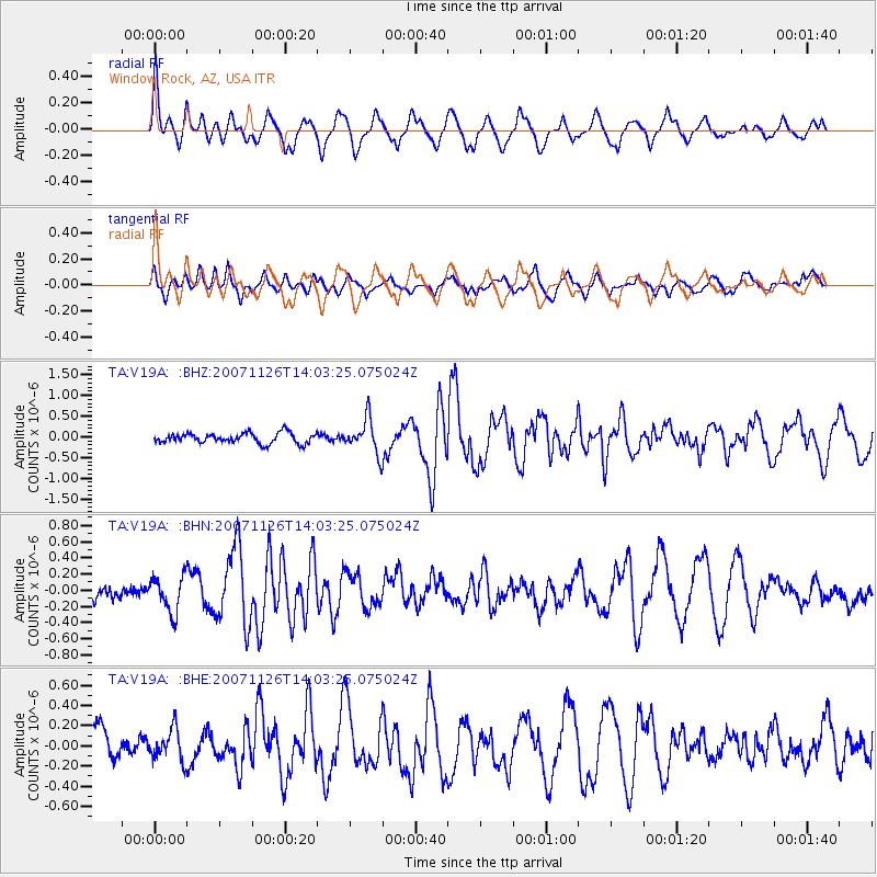
Signal To Noise
| Channel | StoN | STA | LTA |
| TA:V19A: :BHN:20071126T14:03:25.075024Z | 1.4640627 | 2.2339678E-7 | 1.5258689E-7 |
| TA:V19A: :BHE:20071126T14:03:25.075024Z | 0.592846 | 1.5703189E-7 | 2.6487805E-7 |
| TA:V19A: :BHZ:20071126T14:03:25.075024Z | 3.3064723 | 4.068099E-7 | 1.2303443E-7 |
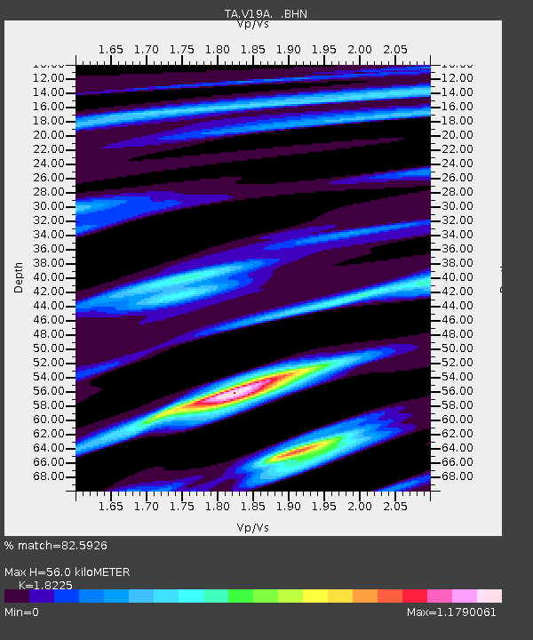
| Arrivals | |
| Ps | 7.3 SECOND |
| PpPs | 24 SECOND |
| PsPs/PpSs | 31 SECOND |

