You are here: Home > Network List > CI - Caltech Regional Seismic Network Stations List
> Station MPP McPhearson Peak > Earthquake Result Viewer
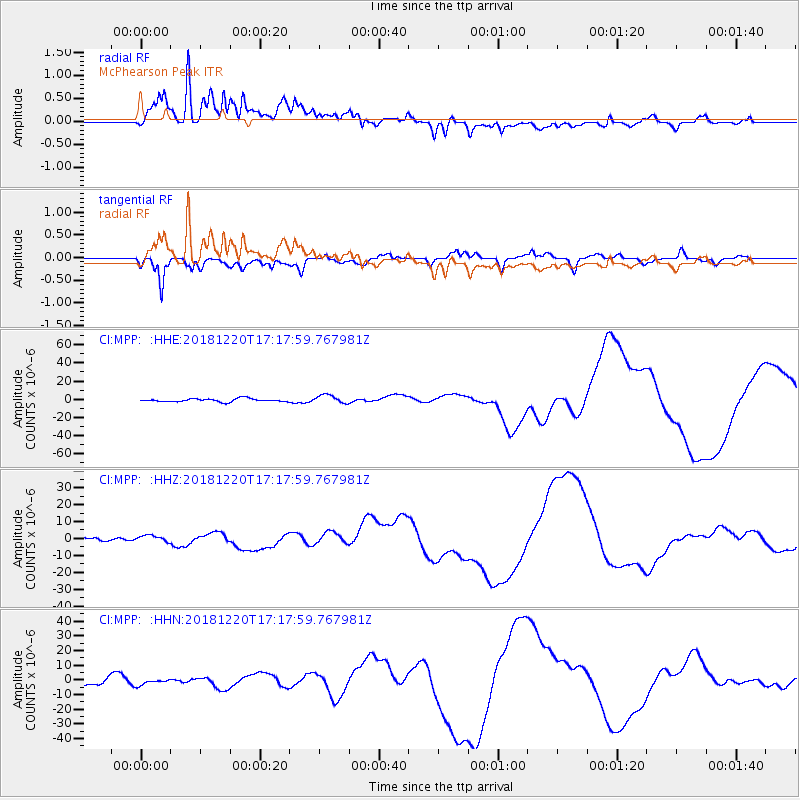
MPP McPhearson Peak - Earthquake Result Viewer
*The percent match for this event was below the threshold and hence no stack was calculated.
| Earthquake location: |
Komandorskiye Ostrova Region |
| Earthquake latitude/longitude: |
54.9/164.8 |
| Earthquake time(UTC): |
2018/12/20 (354) 17:09:04 GMT |
| Earthquake Depth: |
10 km |
| Earthquake Magnitude: |
5.9 mb |
| Earthquake Catalog/Contributor: |
NEIC PDE/us |
|
| Network: |
CI Caltech Regional Seismic Network |
| Station: |
MPP McPhearson Peak |
| Lat/Lon: |
34.89 N/119.81 W |
| Elevation: |
1739 m |
|
| Distance: |
54.2 deg |
| Az: |
78.637 deg |
| Baz: |
316.462 deg |
| Ray Param: |
$rayparam |
*The percent match for this event was below the threshold and hence was not used in the summary stack. |
|
| Radial Match: |
74.10678 % |
| Radial Bump: |
400 |
| Transverse Match: |
59.364002 % |
| Transverse Bump: |
400 |
| SOD ConfigId: |
13570011 |
| Insert Time: |
2019-05-02 02:29:41.362 +0000 |
| GWidth: |
2.5 |
| Max Bumps: |
400 |
| Tol: |
0.001 |
|
Signal To Noise
| Channel | StoN | STA | LTA |
| CI:MPP: :HHZ:20181220T17:17:59.767981Z | 1.0684934 | 2.0800392E-6 | 1.946703E-6 |
| CI:MPP: :HHN:20181220T17:17:59.767981Z | 1.0888535 | 1.9098222E-6 | 1.7539754E-6 |
| CI:MPP: :HHE:20181220T17:17:59.767981Z | 2.6317303 | 4.6169325E-6 | 1.7543334E-6 |
| Arrivals |
| Ps | |
| PpPs | |
| PsPs/PpSs | |


