You are here: Home > Network List > TA - USArray Transportable Network (new EarthScope stations) Stations List
> Station M31M Drury Creek, Yukon, CA > Earthquake Result Viewer
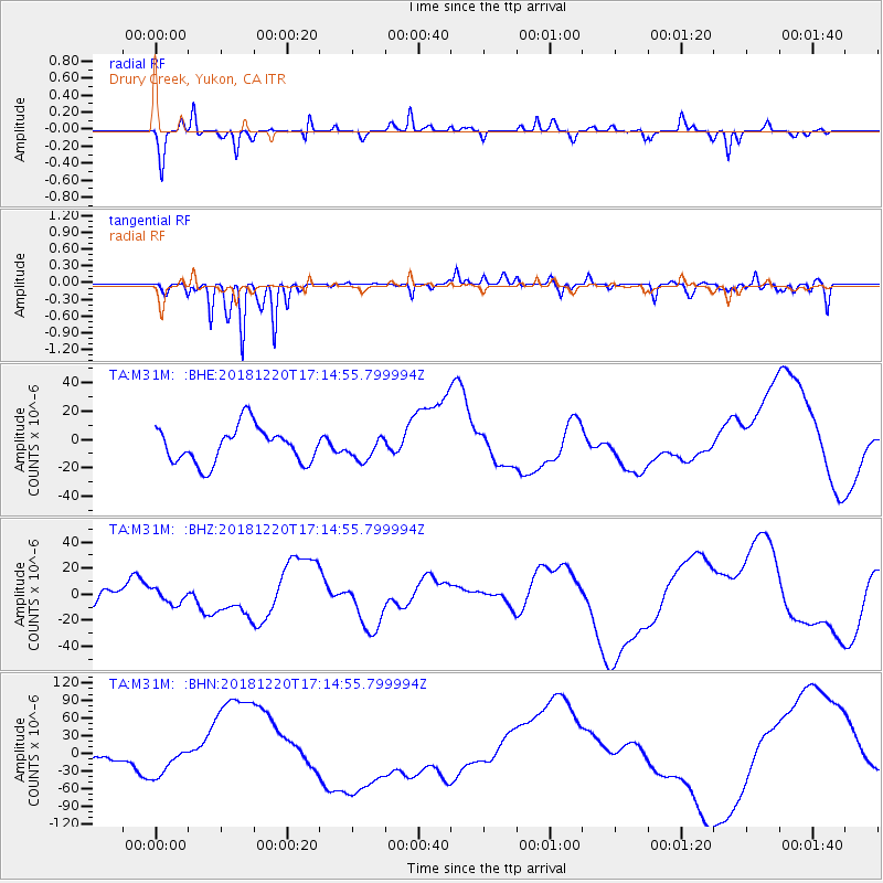
M31M Drury Creek, Yukon, CA - Earthquake Result Viewer
*The percent match for this event was below the threshold and hence no stack was calculated.
| Earthquake location: |
Komandorskiye Ostrova Region |
| Earthquake latitude/longitude: |
54.9/164.8 |
| Earthquake time(UTC): |
2018/12/20 (354) 17:09:04 GMT |
| Earthquake Depth: |
10 km |
| Earthquake Magnitude: |
5.9 mb |
| Earthquake Catalog/Contributor: |
NEIC PDE/us |
|
| Network: |
TA USArray Transportable Network (new EarthScope stations) |
| Station: |
M31M Drury Creek, Yukon, CA |
| Lat/Lon: |
62.20 N/134.39 W |
| Elevation: |
639 m |
|
| Distance: |
31.5 deg |
| Az: |
51.666 deg |
| Baz: |
284.887 deg |
| Ray Param: |
$rayparam |
*The percent match for this event was below the threshold and hence was not used in the summary stack. |
|
| Radial Match: |
71.30687 % |
| Radial Bump: |
222 |
| Transverse Match: |
56.235435 % |
| Transverse Bump: |
198 |
| SOD ConfigId: |
13570011 |
| Insert Time: |
2019-05-02 02:35:27.381 +0000 |
| GWidth: |
2.5 |
| Max Bumps: |
400 |
| Tol: |
0.001 |
|
Signal To Noise
| Channel | StoN | STA | LTA |
| TA:M31M: :BHZ:20181220T17:14:55.799994Z | 0.45464396 | 5.26631E-6 | 1.1583371E-5 |
| TA:M31M: :BHN:20181220T17:14:55.799994Z | 1.3798763 | 2.3935125E-5 | 1.7345848E-5 |
| TA:M31M: :BHE:20181220T17:14:55.799994Z | 0.63918805 | 8.096642E-6 | 1.2667073E-5 |
| Arrivals |
| Ps | |
| PpPs | |
| PsPs/PpSs | |


