You are here: Home > Network List > TA - USArray Transportable Network (new EarthScope stations) Stations List
> Station G31M Satah River, YT, CAN > Earthquake Result Viewer
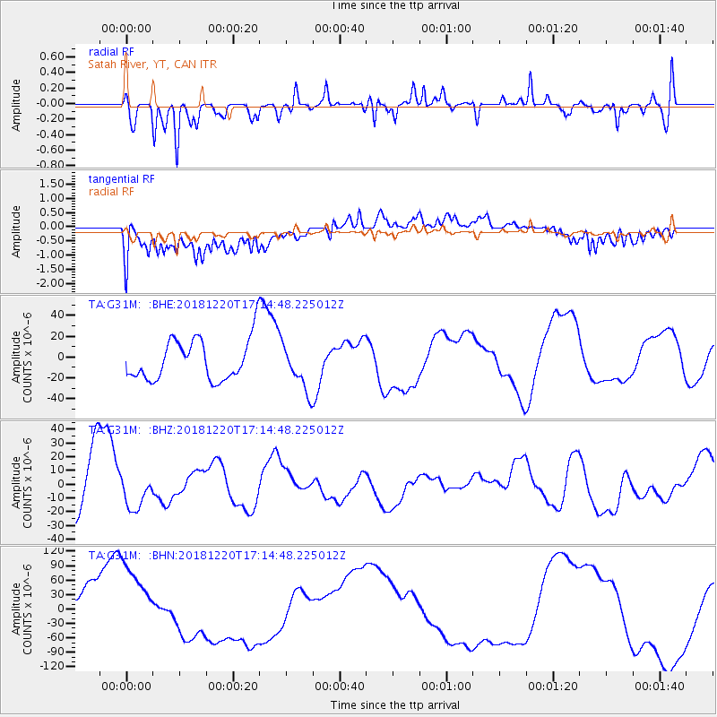
G31M Satah River, YT, CAN - Earthquake Result Viewer
*The percent match for this event was below the threshold and hence no stack was calculated.
| Earthquake location: |
Komandorskiye Ostrova Region |
| Earthquake latitude/longitude: |
54.9/164.8 |
| Earthquake time(UTC): |
2018/12/20 (354) 17:09:04 GMT |
| Earthquake Depth: |
10 km |
| Earthquake Magnitude: |
5.9 mb |
| Earthquake Catalog/Contributor: |
NEIC PDE/us |
|
| Network: |
TA USArray Transportable Network (new EarthScope stations) |
| Station: |
G31M Satah River, YT, CAN |
| Lat/Lon: |
66.92 N/134.27 W |
| Elevation: |
61 m |
|
| Distance: |
30.6 deg |
| Az: |
42.615 deg |
| Baz: |
277.235 deg |
| Ray Param: |
$rayparam |
*The percent match for this event was below the threshold and hence was not used in the summary stack. |
|
| Radial Match: |
57.20295 % |
| Radial Bump: |
400 |
| Transverse Match: |
32.227833 % |
| Transverse Bump: |
400 |
| SOD ConfigId: |
13570011 |
| Insert Time: |
2019-05-02 02:35:27.606 +0000 |
| GWidth: |
2.5 |
| Max Bumps: |
400 |
| Tol: |
0.001 |
|
Signal To Noise
| Channel | StoN | STA | LTA |
| TA:G31M: :BHZ:20181220T17:14:48.225012Z | 0.55423415 | 1.19976985E-5 | 2.1647345E-5 |
| TA:G31M: :BHN:20181220T17:14:48.225012Z | 2.0528429 | 7.666988E-5 | 3.7348145E-5 |
| TA:G31M: :BHE:20181220T17:14:48.225012Z | 1.1285826 | 2.2256661E-5 | 1.9720896E-5 |
| Arrivals |
| Ps | |
| PpPs | |
| PsPs/PpSs | |


