You are here: Home > Network List > TA - USArray Transportable Network (new EarthScope stations) Stations List
> Station R31K City Hall, Gustavus, AK, USA > Earthquake Result Viewer
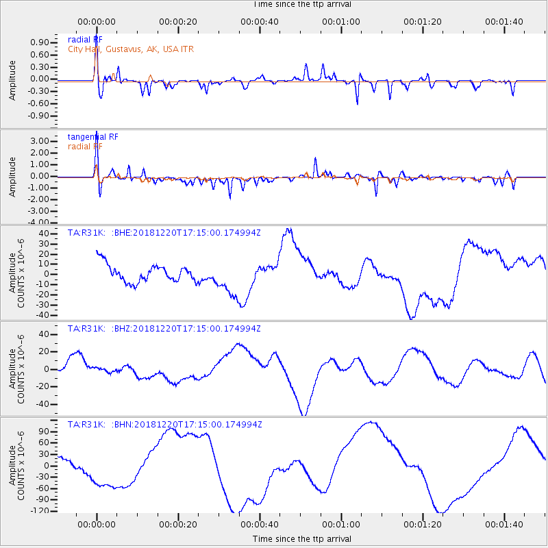
R31K City Hall, Gustavus, AK, USA - Earthquake Result Viewer
*The percent match for this event was below the threshold and hence no stack was calculated.
| Earthquake location: |
Komandorskiye Ostrova Region |
| Earthquake latitude/longitude: |
54.9/164.8 |
| Earthquake time(UTC): |
2018/12/20 (354) 17:09:04 GMT |
| Earthquake Depth: |
10 km |
| Earthquake Magnitude: |
5.9 mb |
| Earthquake Catalog/Contributor: |
NEIC PDE/us |
|
| Network: |
TA USArray Transportable Network (new EarthScope stations) |
| Station: |
R31K City Hall, Gustavus, AK, USA |
| Lat/Lon: |
58.41 N/135.74 W |
| Elevation: |
15 m |
|
| Distance: |
32.0 deg |
| Az: |
58.954 deg |
| Baz: |
289.919 deg |
| Ray Param: |
$rayparam |
*The percent match for this event was below the threshold and hence was not used in the summary stack. |
|
| Radial Match: |
65.167725 % |
| Radial Bump: |
390 |
| Transverse Match: |
68.41446 % |
| Transverse Bump: |
400 |
| SOD ConfigId: |
13570011 |
| Insert Time: |
2019-05-02 02:35:32.963 +0000 |
| GWidth: |
2.5 |
| Max Bumps: |
400 |
| Tol: |
0.001 |
|
Signal To Noise
| Channel | StoN | STA | LTA |
| TA:R31K: :BHZ:20181220T17:15:00.174994Z | 0.3289199 | 2.6805171E-6 | 8.149453E-6 |
| TA:R31K: :BHN:20181220T17:15:00.174994Z | 3.8531277 | 5.4216118E-5 | 1.4070678E-5 |
| TA:R31K: :BHE:20181220T17:15:00.174994Z | 2.08137 | 1.7811066E-5 | 8.557376E-6 |
| Arrivals |
| Ps | |
| PpPs | |
| PsPs/PpSs | |


