V19A Window Rock, AZ, USA - Earthquake Result Viewer
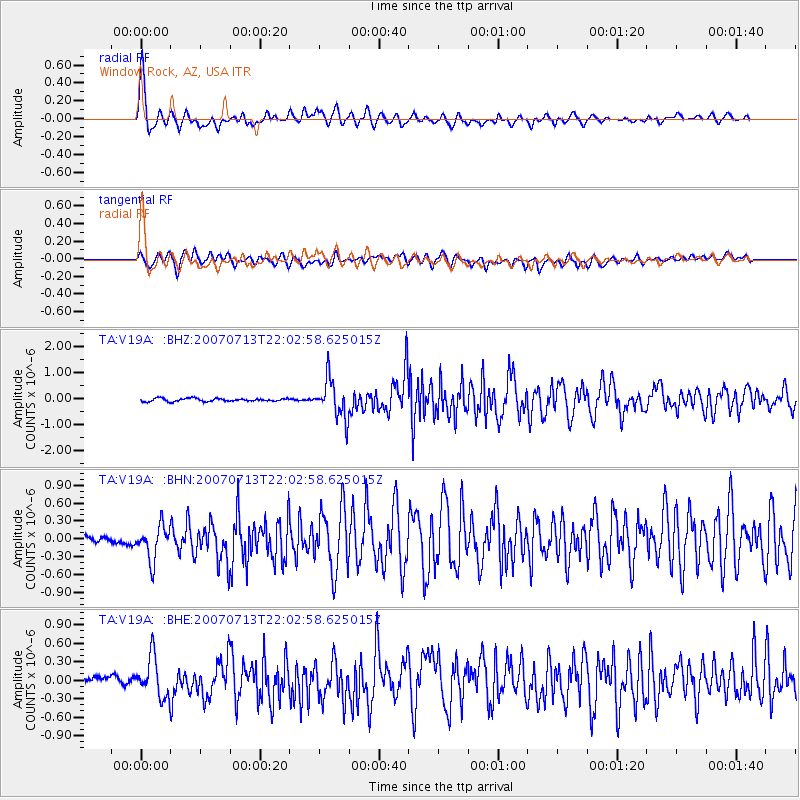
Earthquake location: Andreanof Islands, Aleutian Is.
Earthquake latitude/longitude: 51.8/-176.3
Earthquake time(UTC): 2007/07/13 (194) 21:54:43 GMT
Earthquake Depth: 35 km
Earthquake Magnitude: 5.7 MB, 5.6 MS, 6.0 MW, 5.9 MW
Earthquake Catalog/Contributor: WHDF/NEIC
Network: TA USArray Transportable Network (new EarthScope stations)
Station: V19A Window Rock, AZ, USA
Lat/Lon: 35.71 N/109.05 W
Elevation: 2082 m
Distance: 49.4 deg
Az: 81.39 deg
Baz: 311.076 deg
Ray Param: 0.0686748
Estimated Moho Depth: 17.0 km
Estimated Crust Vp/Vs: 2.10
Assumed Crust Vp: 6.496 km/s
Estimated Crust Vs: 3.097 km/s
Estimated Crust Poisson's Ratio: 0.35
Radial Match: 92.399445 %
Radial Bump: 400
Transverse Match: 82.07613 %
Transverse Bump: 400
SOD ConfigId: 2564
Insert Time: 2010-03-06 18:46:17.427 +0000
GWidth: 2.5
Max Bumps: 400
Tol: 0.001

Signal To Noise

ChannelStoNSTALTA
TA:V19A: :BHN:20070713T22:02:58.625015Z4.88944863.0180985E-76.1726766E-8
TA:V19A: :BHE:20070713T22:02:58.625015Z4.73102143.2502828E-76.87015E-8
TA:V19A: :BHZ:20070713T22:02:58.625015Z12.9973867.464569E-75.7431308E-8
Arrivals
Ps3.0 SECOND
PpPs7.7 SECOND
PsPs/PpSs11 SECOND