You are here: Home > Network List > AZ - ANZA Regional Network Stations List
> Station SMER AZ.SMER > Earthquake Result Viewer
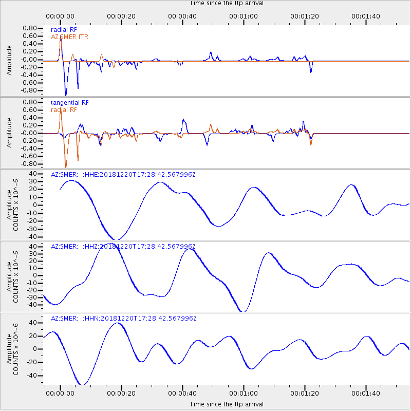
SMER AZ.SMER - Earthquake Result Viewer
*The percent match for this event was below the threshold and hence no stack was calculated.
| Earthquake location: |
Komandorskiye Ostrova Region |
| Earthquake latitude/longitude: |
55.1/164.9 |
| Earthquake time(UTC): |
2018/12/20 (354) 17:19:29 GMT |
| Earthquake Depth: |
10 km |
| Earthquake Magnitude: |
5.6 mb |
| Earthquake Catalog/Contributor: |
NEIC PDE/us |
|
| Network: |
AZ ANZA Regional Network |
| Station: |
SMER AZ.SMER |
| Lat/Lon: |
33.46 N/117.17 W |
| Elevation: |
355 m |
|
| Distance: |
56.7 deg |
| Az: |
78.053 deg |
| Baz: |
317.692 deg |
| Ray Param: |
$rayparam |
*The percent match for this event was below the threshold and hence was not used in the summary stack. |
|
| Radial Match: |
81.34611 % |
| Radial Bump: |
370 |
| Transverse Match: |
49.30987 % |
| Transverse Bump: |
243 |
| SOD ConfigId: |
13570011 |
| Insert Time: |
2019-05-02 02:38:43.444 +0000 |
| GWidth: |
2.5 |
| Max Bumps: |
400 |
| Tol: |
0.001 |
|
Signal To Noise
| Channel | StoN | STA | LTA |
| AZ:SMER: :HHZ:20181220T17:28:42.567996Z | 2.4396586 | 3.5552548E-5 | 1.45727545E-5 |
| AZ:SMER: :HHN:20181220T17:28:42.567996Z | 2.868931 | 2.1402202E-5 | 7.459992E-6 |
| AZ:SMER: :HHE:20181220T17:28:42.567996Z | 1.1260182 | 3.203056E-5 | 2.8445862E-5 |
| Arrivals |
| Ps | |
| PpPs | |
| PsPs/PpSs | |


