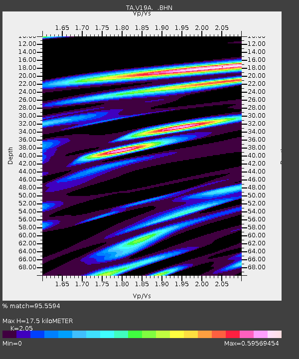
V19A Window Rock, AZ, USA - Earthquake Result Viewer
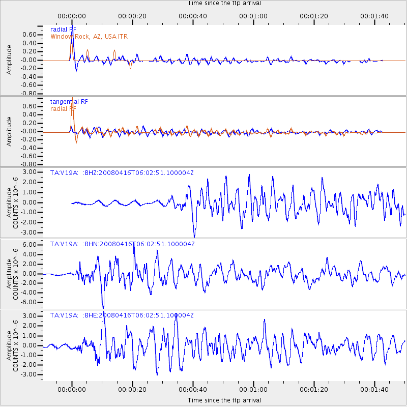
Earthquake location: Andreanof Islands, Aleutian Is.
Earthquake latitude/longitude: 51.9/-179.2
Earthquake time(UTC): 2008/04/16 (107) 05:54:19 GMT
Earthquake Depth: 13 km
Earthquake Magnitude: 6.1 MB, 6.5 MS, 6.6 MW, 6.6 MW
Earthquake Catalog/Contributor: WHDF/NEIC
Network: TA USArray Transportable Network (new EarthScope stations)
Station: V19A Window Rock, AZ, USA
Lat/Lon: 35.71 N/109.05 W
Elevation: 2082 m
Distance: 51.1 deg
Az: 79.407 deg
Baz: 311.516 deg
Ray Param: 0.06760052
Estimated Moho Depth: 17.5 km
Estimated Crust Vp/Vs: 2.05
Assumed Crust Vp: 6.496 km/s
Estimated Crust Vs: 3.169 km/s
Estimated Crust Poisson's Ratio: 0.34
Radial Match: 95.5594 %
Radial Bump: 400
Transverse Match: 89.31383 %
Transverse Bump: 400
SOD ConfigId: 2504
Insert Time: 2010-03-06 18:46:23.976 +0000
GWidth: 2.5
Max Bumps: 400
Tol: 0.001

Signal To Noise

ChannelStoNSTALTA
TA:V19A: :BHN:20080416T06:02:51.100004Z10.2738597.7525857E-77.545933E-8
TA:V19A: :BHE:20080416T06:02:51.100004Z2.56398843.3802206E-71.3183447E-7
TA:V19A: :BHZ:20080416T06:02:51.100004Z2.10287573.186837E-71.5154662E-7
Arrivals
Ps3.0 SECOND
PpPs7.8 SECOND
PsPs/PpSs11 SECOND