
V19A Window Rock, AZ, USA - Earthquake Result Viewer
| ||||||||||||||||||
| ||||||||||||||||||
| ||||||||||||||||||
|
Signal To Noise
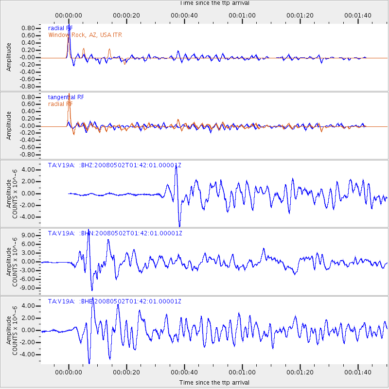
| Channel | StoN | STA | LTA |
| TA:V19A: :BHN:20080502T01:42:01.00001Z | 5.5886354 | 1.4191761E-6 | 2.5393965E-7 |
| TA:V19A: :BHE:20080502T01:42:01.00001Z | 3.2292228 | 7.4790427E-7 | 2.3160504E-7 |
| TA:V19A: :BHZ:20080502T01:42:01.00001Z | 5.498466 | 6.439373E-7 | 1.1711217E-7 |
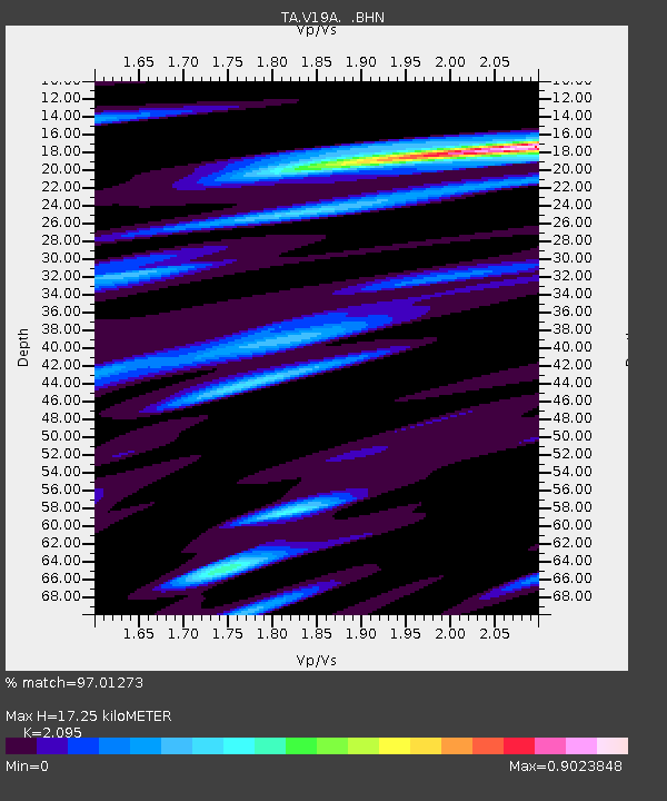
| Arrivals | |
| Ps | 3.1 SECOND |
| PpPs | 7.8 SECOND |
| PsPs/PpSs | 11 SECOND |

