You are here: Home > Network List > TS - TERRAscope (Southern California Seismic Network) Stations List
> Station BAR Barrett Dam, California, USA > Earthquake Result Viewer
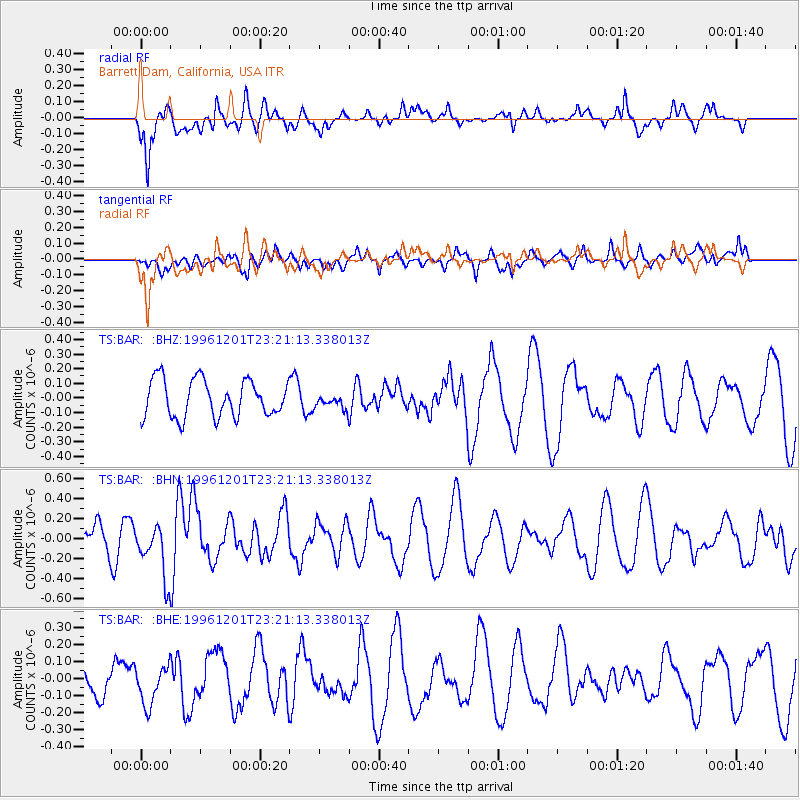
BAR Barrett Dam, California, USA - Earthquake Result Viewer
*The percent match for this event was below the threshold and hence no stack was calculated.
| Earthquake location: |
Kermadec Islands Region |
| Earthquake latitude/longitude: |
-30.5/-179.7 |
| Earthquake time(UTC): |
1996/12/01 (336) 23:09:40 GMT |
| Earthquake Depth: |
356 km |
| Earthquake Magnitude: |
5.3 MB, 6.1 UNKNOWN, 6.0 MW |
| Earthquake Catalog/Contributor: |
WHDF/NEIC |
|
| Network: |
TS TERRAscope (Southern California Seismic Network) |
| Station: |
BAR Barrett Dam, California, USA |
| Lat/Lon: |
32.68 N/116.67 W |
| Elevation: |
548 m |
|
| Distance: |
86.6 deg |
| Az: |
48.829 deg |
| Baz: |
230.374 deg |
| Ray Param: |
$rayparam |
*The percent match for this event was below the threshold and hence was not used in the summary stack. |
|
| Radial Match: |
61.63318 % |
| Radial Bump: |
366 |
| Transverse Match: |
52.33566 % |
| Transverse Bump: |
400 |
| SOD ConfigId: |
4480 |
| Insert Time: |
2010-02-26 14:02:10.775 +0000 |
| GWidth: |
2.5 |
| Max Bumps: |
400 |
| Tol: |
0.001 |
|
Signal To Noise
| Channel | StoN | STA | LTA |
| TS:BAR: :BHN:19961201T23:21:13.338013Z | 2.1367764 | 2.750292E-7 | 1.287122E-7 |
| TS:BAR: :BHE:19961201T23:21:13.338013Z | 1.0235444 | 1.15740804E-7 | 1.1307843E-7 |
| TS:BAR: :BHZ:19961201T23:21:13.338013Z | 0.38379744 | 4.854368E-8 | 1.2648255E-7 |
| Arrivals |
| Ps | |
| PpPs | |
| PsPs/PpSs | |


