You are here: Home > Network List > WY - Yellowstone Wyoming Seismic Network Stations List
> Station YUF Upper Falls, WY, USA > Earthquake Result Viewer
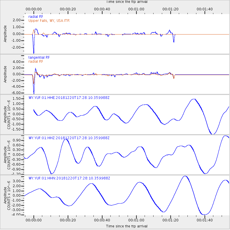
YUF Upper Falls, WY, USA - Earthquake Result Viewer
*The percent match for this event was below the threshold and hence no stack was calculated.
| Earthquake location: |
Komandorskiye Ostrova Region |
| Earthquake latitude/longitude: |
55.1/164.9 |
| Earthquake time(UTC): |
2018/12/20 (354) 17:19:29 GMT |
| Earthquake Depth: |
10 km |
| Earthquake Magnitude: |
5.6 mb |
| Earthquake Catalog/Contributor: |
NEIC PDE/us |
|
| Network: |
WY Yellowstone Wyoming Seismic Network |
| Station: |
YUF Upper Falls, WY, USA |
| Lat/Lon: |
44.71 N/110.51 W |
| Elevation: |
2394 m |
|
| Distance: |
52.3 deg |
| Az: |
63.844 deg |
| Baz: |
313.606 deg |
| Ray Param: |
$rayparam |
*The percent match for this event was below the threshold and hence was not used in the summary stack. |
|
| Radial Match: |
49.746567 % |
| Radial Bump: |
400 |
| Transverse Match: |
62.43454 % |
| Transverse Bump: |
400 |
| SOD ConfigId: |
13570011 |
| Insert Time: |
2019-05-02 02:46:52.264 +0000 |
| GWidth: |
2.5 |
| Max Bumps: |
400 |
| Tol: |
0.001 |
|
Signal To Noise
| Channel | StoN | STA | LTA |
| WY:YUF:01:HHZ:20181220T17:28:10.359988Z | 1.1543062 | 3.679021E-7 | 3.187214E-7 |
| WY:YUF:01:HHN:20181220T17:28:10.359988Z | 1.4640545 | 1.5278362E-6 | 1.0435651E-6 |
| WY:YUF:01:HHE:20181220T17:28:10.359988Z | 1.2115806 | 3.6425155E-7 | 3.0064157E-7 |
| Arrivals |
| Ps | |
| PpPs | |
| PsPs/PpSs | |


