
N17A Moffit Pass, UT, USA - Earthquake Result Viewer
| ||||||||||||||||||
| ||||||||||||||||||
| ||||||||||||||||||
|
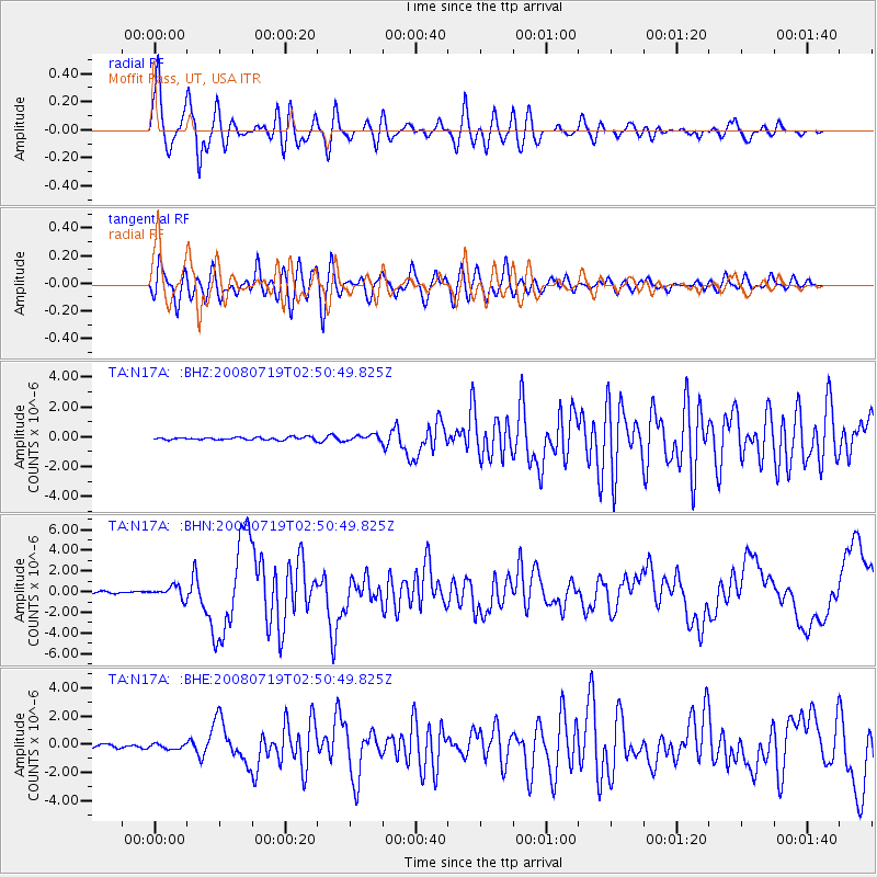
Signal To Noise
| Channel | StoN | STA | LTA |
| TA:N17A: :BHN:20080719T02:50:49.825Z | 5.0758357 | 5.639706E-7 | 1.1110892E-7 |
| TA:N17A: :BHE:20080719T02:50:49.825Z | 1.2401855 | 1.8621255E-7 | 1.5014895E-7 |
| TA:N17A: :BHZ:20080719T02:50:49.825Z | 2.263298 | 1.9504024E-7 | 8.6175234E-8 |
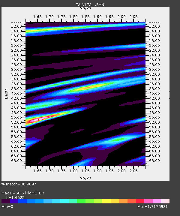
| Arrivals | |
| Ps | 5.5 SECOND |
| PpPs | 21 SECOND |
| PsPs/PpSs | 27 SECOND |

