N17A Moffit Pass, UT, USA - Earthquake Result Viewer
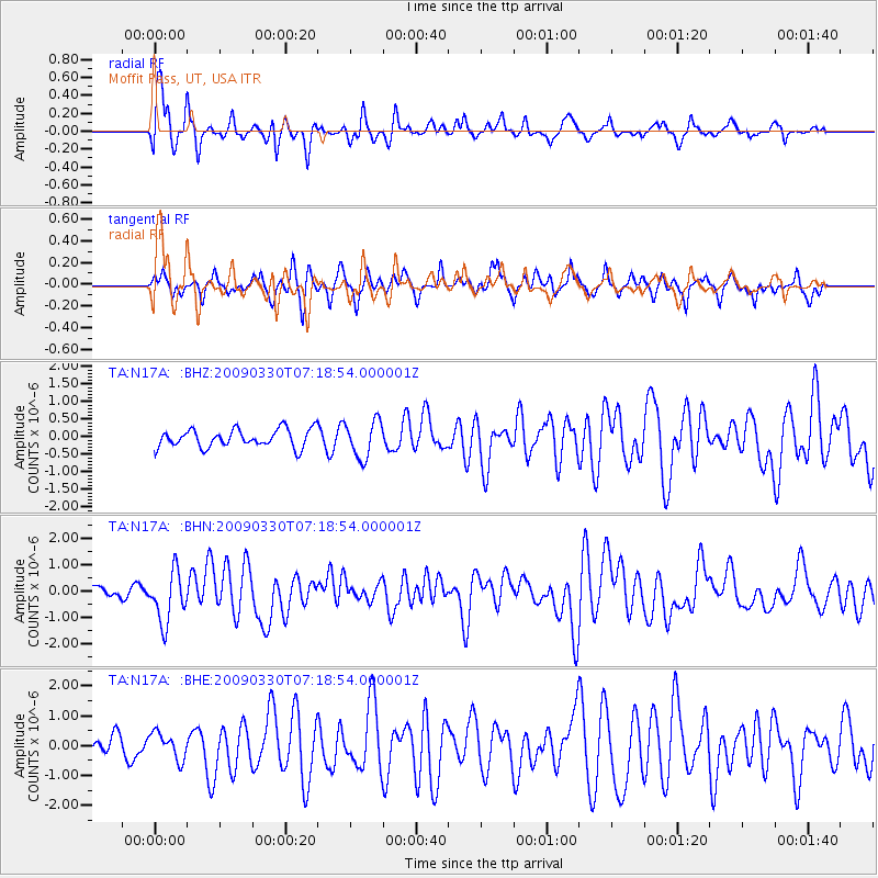
Earthquake location: Kodiak Island Region, Alaska
Earthquake latitude/longitude: 56.5/-152.7
Earthquake time(UTC): 2009/03/30 (089) 07:13:07 GMT
Earthquake Depth: 21 km
Earthquake Magnitude: 5.9 MB, 5.9 MS, 5.9 MW, 5.9 MW
Earthquake Catalog/Contributor: WHDF/NEIC
Network: TA USArray Transportable Network (new EarthScope stations)
Station: N17A Moffit Pass, UT, USA
Lat/Lon: 40.94 N/110.83 W
Elevation: 2500 m
Distance: 31.2 deg
Az: 102.033 deg
Baz: 314.353 deg
Ray Param: 0.07912972
Estimated Moho Depth: 11.25 km
Estimated Crust Vp/Vs: 1.95
Assumed Crust Vp: 6.155 km/s
Estimated Crust Vs: 3.16 km/s
Estimated Crust Poisson's Ratio: 0.32
Radial Match: 83.73994 %
Radial Bump: 400
Transverse Match: 62.450386 %
Transverse Bump: 373
SOD ConfigId: 2658
Insert Time: 2010-03-06 18:48:06.377 +0000
GWidth: 2.5
Max Bumps: 400
Tol: 0.001

Signal To Noise

ChannelStoNSTALTA
TA:N17A: :BHN:20090330T07:18:54.000001Z5.9911319.748816E-71.627208E-7
TA:N17A: :BHE:20090330T07:18:54.000001Z0.98499744.4422276E-74.5098875E-7
TA:N17A: :BHZ:20090330T07:18:54.000001Z2.06491285.2606634E-72.5476444E-7
Arrivals
Ps1.9 SECOND
PpPs5.0 SECOND
PsPs/PpSs6.9 SECOND