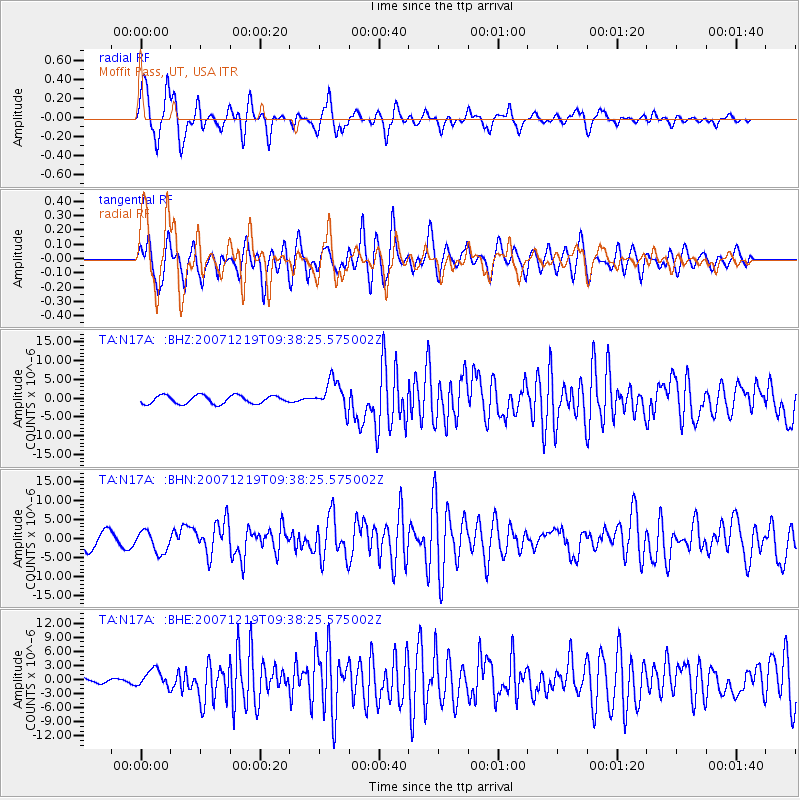
N17A Moffit Pass, UT, USA - Earthquake Result Viewer
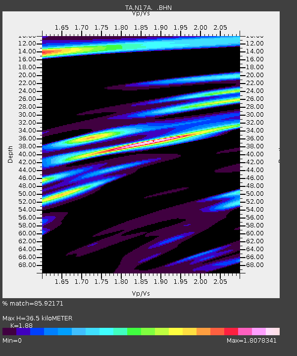
Earthquake location: Andreanof Islands, Aleutian Is.
Earthquake latitude/longitude: 51.4/-179.5
Earthquake time(UTC): 2007/12/19 (353) 09:30:27 GMT
Earthquake Depth: 29 km
Earthquake Magnitude: 6.4 MB, 7.1 MS, 7.1 MW, 7.0 MW
Earthquake Catalog/Contributor: WHDF/NEIC
Network: TA USArray Transportable Network (new EarthScope stations)
Station: N17A Moffit Pass, UT, USA
Lat/Lon: 40.94 N/110.83 W
Elevation: 2500 m
Distance: 47.1 deg
Az: 74.572 deg
Baz: 307.082 deg
Ray Param: 0.07018262
Estimated Moho Depth: 36.5 km
Estimated Crust Vp/Vs: 1.88
Assumed Crust Vp: 6.155 km/s
Estimated Crust Vs: 3.274 km/s
Estimated Crust Poisson's Ratio: 0.30
Radial Match: 85.92171 %
Radial Bump: 400
Transverse Match: 76.55078 %
Transverse Bump: 400
SOD ConfigId: 2564
Insert Time: 2010-03-06 18:48:09.666 +0000
GWidth: 2.5
Max Bumps: 400
Tol: 0.001

Signal To Noise

ChannelStoNSTALTA
TA:N17A: :BHN:20071219T09:38:25.575002Z1.49066042.8339268E-61.9011215E-6
TA:N17A: :BHE:20071219T09:38:25.575002Z3.6757861.8148265E-64.9372477E-7
TA:N17A: :BHZ:20071219T09:38:25.575002Z3.68392013.9792512E-61.0801676E-6
Arrivals
Ps5.5 SECOND
PpPs16 SECOND
PsPs/PpSs22 SECOND