N17A Moffit Pass, UT, USA - Earthquake Result Viewer
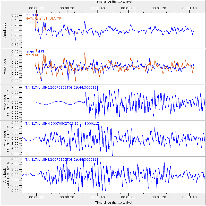
Earthquake location: Andreanof Islands, Aleutian Is.
Earthquake latitude/longitude: 51.3/-180.0
Earthquake time(UTC): 2007/08/02 (214) 03:21:42 GMT
Earthquake Depth: 21 km
Earthquake Magnitude: 6.3 MB, 6.6 MS, 6.7 MW, 6.6 MW
Earthquake Catalog/Contributor: WHDF/NEIC
Network: TA USArray Transportable Network (new EarthScope stations)
Station: N17A Moffit Pass, UT, USA
Lat/Lon: 40.94 N/110.83 W
Elevation: 2500 m
Distance: 47.4 deg
Az: 74.242 deg
Baz: 307.111 deg
Ray Param: 0.070017956
Estimated Moho Depth: 49.25 km
Estimated Crust Vp/Vs: 1.66
Assumed Crust Vp: 6.155 km/s
Estimated Crust Vs: 3.702 km/s
Estimated Crust Poisson's Ratio: 0.22
Radial Match: 81.0965 %
Radial Bump: 400
Transverse Match: 60.66415 %
Transverse Bump: 400
SOD ConfigId: 2564
Insert Time: 2010-03-06 18:48:18.285 +0000
GWidth: 2.5
Max Bumps: 400
Tol: 0.001

Signal To Noise

ChannelStoNSTALTA
TA:N17A: :BHN:20070802T03:29:44.300011Z1.02430938.915005E-78.703431E-7
TA:N17A: :BHE:20070802T03:29:44.300011Z1.2810011.0999714E-68.5868123E-7
TA:N17A: :BHZ:20070802T03:29:44.300011Z3.83740332.5605991E-66.672739E-7
Arrivals
Ps5.6 SECOND
PpPs20 SECOND
PsPs/PpSs26 SECOND