You are here: Home > Network List > US - United States National Seismic Network Stations List
> Station DGMT Dagmar, Montana, USA > Earthquake Result Viewer
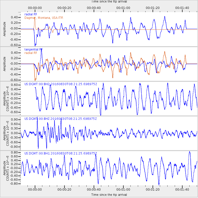
DGMT Dagmar, Montana, USA - Earthquake Result Viewer
*The percent match for this event was below the threshold and hence no stack was calculated.
| Earthquake location: |
Near Coast Of Central Chile |
| Earthquake latitude/longitude: |
-34.9/-72.5 |
| Earthquake time(UTC): |
2016/08/30 (243) 08:09:10 GMT |
| Earthquake Depth: |
19 km |
| Earthquake Magnitude: |
5.5 MB, 5.5 MB |
| Earthquake Catalog/Contributor: |
NEIC PDE/NEIC ALERT |
|
| Network: |
US United States National Seismic Network |
| Station: |
DGMT Dagmar, Montana, USA |
| Lat/Lon: |
48.47 N/104.20 W |
| Elevation: |
0.0 m |
|
| Distance: |
87.7 deg |
| Az: |
339.534 deg |
| Baz: |
154.415 deg |
| Ray Param: |
$rayparam |
*The percent match for this event was below the threshold and hence was not used in the summary stack. |
|
| Radial Match: |
50.315384 % |
| Radial Bump: |
400 |
| Transverse Match: |
47.11951 % |
| Transverse Bump: |
400 |
| SOD ConfigId: |
1634031 |
| Insert Time: |
2016-09-13 08:13:39.910 +0000 |
| GWidth: |
2.5 |
| Max Bumps: |
400 |
| Tol: |
0.001 |
|
Signal To Noise
| Channel | StoN | STA | LTA |
| US:DGMT:00:BHZ:20160830T08:21:25.698975Z | 2.7449865 | 3.5606269E-7 | 1.2971381E-7 |
| US:DGMT:00:BH1:20160830T08:21:25.698975Z | 0.4301427 | 1.7662818E-7 | 4.106269E-7 |
| US:DGMT:00:BH2:20160830T08:21:25.698975Z | 0.592433 | 1.8444219E-7 | 3.1133004E-7 |
| Arrivals |
| Ps | |
| PpPs | |
| PsPs/PpSs | |


