You are here: Home > Network List > TA - USArray Transportable Network (new EarthScope stations) Stations List
> Station N17A Moffit Pass, UT, USA > Earthquake Result Viewer
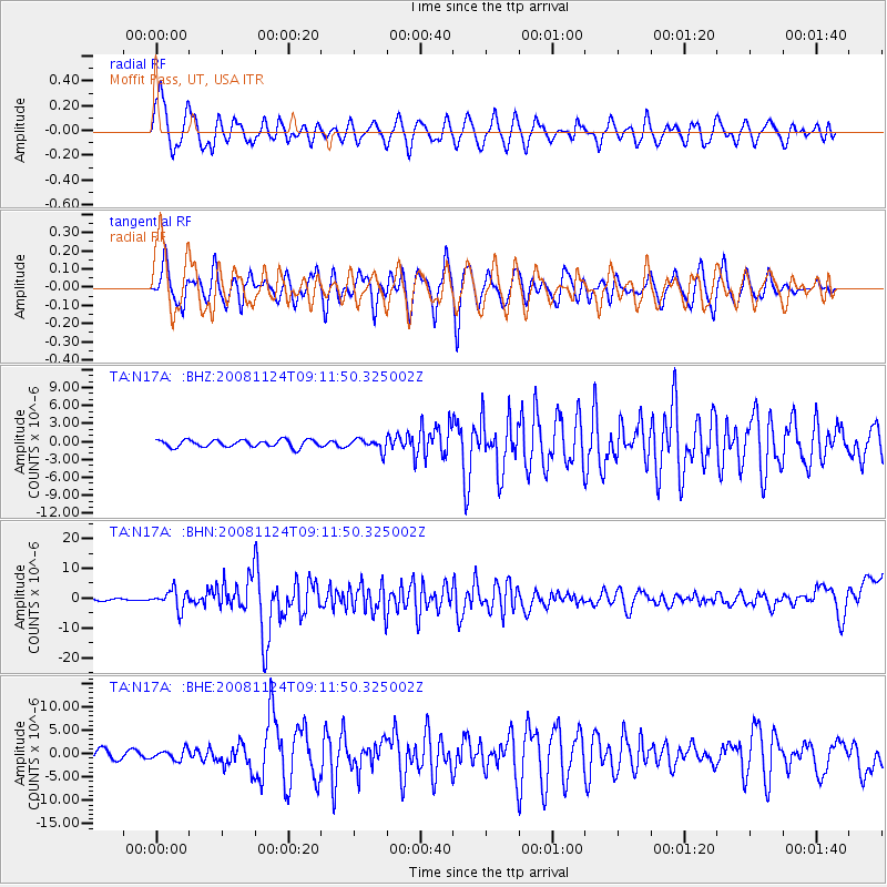
N17A Moffit Pass, UT, USA - Earthquake Result Viewer
*The percent match for this event was below the threshold and hence no stack was calculated.
| Earthquake location: |
Sea Of Okhotsk |
| Earthquake latitude/longitude: |
54.2/154.3 |
| Earthquake time(UTC): |
2008/11/24 (329) 09:02:58 GMT |
| Earthquake Depth: |
492 km |
| Earthquake Magnitude: |
6.5 MB, 7.3 MW, 7.3 MW |
| Earthquake Catalog/Contributor: |
WHDF/NEIC |
|
| Network: |
TA USArray Transportable Network (new EarthScope stations) |
| Station: |
N17A Moffit Pass, UT, USA |
| Lat/Lon: |
40.94 N/110.83 W |
| Elevation: |
2500 m |
|
| Distance: |
60.6 deg |
| Az: |
60.03 deg |
| Baz: |
317.791 deg |
| Ray Param: |
$rayparam |
*The percent match for this event was below the threshold and hence was not used in the summary stack. |
|
| Radial Match: |
71.74402 % |
| Radial Bump: |
400 |
| Transverse Match: |
69.56073 % |
| Transverse Bump: |
400 |
| SOD ConfigId: |
2658 |
| Insert Time: |
2010-03-06 18:48:56.468 +0000 |
| GWidth: |
2.5 |
| Max Bumps: |
400 |
| Tol: |
0.001 |
|
Signal To Noise
| Channel | StoN | STA | LTA |
| TA:N17A: :BHN:20081124T09:11:50.325002Z | 10.450717 | 3.1994746E-6 | 3.0614882E-7 |
| TA:N17A: :BHE:20081124T09:11:50.325002Z | 1.2800555 | 1.0842128E-6 | 8.4700457E-7 |
| TA:N17A: :BHZ:20081124T09:11:50.325002Z | 1.5808403 | 9.563539E-7 | 6.049655E-7 |
| Arrivals |
| Ps | |
| PpPs | |
| PsPs/PpSs | |


