You are here: Home > Network List > TA - USArray Transportable Network (new EarthScope stations) Stations List
> Station R33M Jennings River, BC, CAN > Earthquake Result Viewer
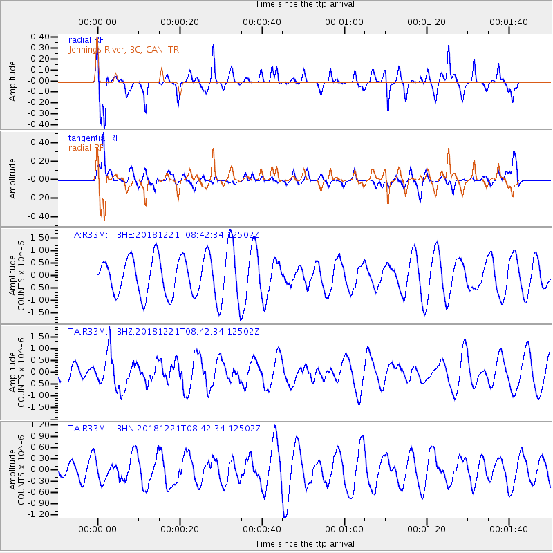
R33M Jennings River, BC, CAN - Earthquake Result Viewer
*The percent match for this event was below the threshold and hence no stack was calculated.
| Earthquake location: |
New Britain Region, P.N.G. |
| Earthquake latitude/longitude: |
-5.4/152.0 |
| Earthquake time(UTC): |
2018/12/21 (355) 08:30:15 GMT |
| Earthquake Depth: |
10 km |
| Earthquake Magnitude: |
5.7 Mww |
| Earthquake Catalog/Contributor: |
NEIC PDE/us |
|
| Network: |
TA USArray Transportable Network (new EarthScope stations) |
| Station: |
R33M Jennings River, BC, CAN |
| Lat/Lon: |
59.39 N/130.97 W |
| Elevation: |
1437 m |
|
| Distance: |
88.1 deg |
| Az: |
29.928 deg |
| Baz: |
256.125 deg |
| Ray Param: |
$rayparam |
*The percent match for this event was below the threshold and hence was not used in the summary stack. |
|
| Radial Match: |
57.1894 % |
| Radial Bump: |
360 |
| Transverse Match: |
57.696396 % |
| Transverse Bump: |
400 |
| SOD ConfigId: |
13570011 |
| Insert Time: |
2019-05-02 03:05:30.235 +0000 |
| GWidth: |
2.5 |
| Max Bumps: |
400 |
| Tol: |
0.001 |
|
Signal To Noise
| Channel | StoN | STA | LTA |
| TA:R33M: :BHZ:20181221T08:42:34.12502Z | 1.6981337 | 7.199056E-7 | 4.239393E-7 |
| TA:R33M: :BHN:20181221T08:42:34.12502Z | 0.6000984 | 2.6376293E-7 | 4.3953284E-7 |
| TA:R33M: :BHE:20181221T08:42:34.12502Z | 1.785356 | 1.287255E-6 | 7.2100744E-7 |
| Arrivals |
| Ps | |
| PpPs | |
| PsPs/PpSs | |


