You are here: Home > Network List > CI - Caltech Regional Seismic Network Stations List
> Station SMM Simmler, CA, USA > Earthquake Result Viewer
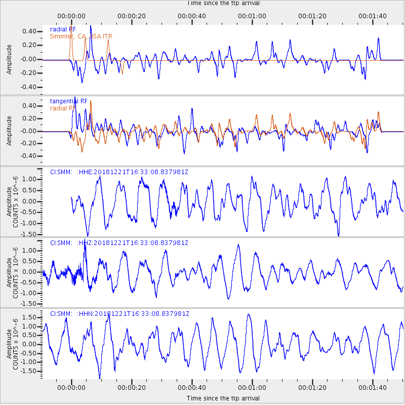
SMM Simmler, CA, USA - Earthquake Result Viewer
*The percent match for this event was below the threshold and hence no stack was calculated.
| Earthquake location: |
Komandorskiye Ostrova Region |
| Earthquake latitude/longitude: |
54.8/164.8 |
| Earthquake time(UTC): |
2018/12/21 (355) 16:24:16 GMT |
| Earthquake Depth: |
10 km |
| Earthquake Magnitude: |
5.0 Mww |
| Earthquake Catalog/Contributor: |
NEIC PDE/us |
|
| Network: |
CI Caltech Regional Seismic Network |
| Station: |
SMM Simmler, CA, USA |
| Lat/Lon: |
35.31 N/120.00 W |
| Elevation: |
599 m |
|
| Distance: |
53.8 deg |
| Az: |
78.357 deg |
| Baz: |
316.076 deg |
| Ray Param: |
$rayparam |
*The percent match for this event was below the threshold and hence was not used in the summary stack. |
|
| Radial Match: |
50.56134 % |
| Radial Bump: |
400 |
| Transverse Match: |
55.332134 % |
| Transverse Bump: |
400 |
| SOD ConfigId: |
13570011 |
| Insert Time: |
2019-05-02 03:07:59.329 +0000 |
| GWidth: |
2.5 |
| Max Bumps: |
400 |
| Tol: |
0.001 |
|
Signal To Noise
| Channel | StoN | STA | LTA |
| CI:SMM: :HHZ:20181221T16:33:08.837981Z | 1.7601804 | 4.7280088E-7 | 2.6860934E-7 |
| CI:SMM: :HHN:20181221T16:33:08.837981Z | 0.6330553 | 4.97071E-7 | 7.8519366E-7 |
| CI:SMM: :HHE:20181221T16:33:08.837981Z | 0.8410388 | 5.888219E-7 | 7.001126E-7 |
| Arrivals |
| Ps | |
| PpPs | |
| PsPs/PpSs | |


