You are here: Home > Network List > CN - Canadian National Seismograph Network Stations List
> Station INK INUVIK, NT > Earthquake Result Viewer
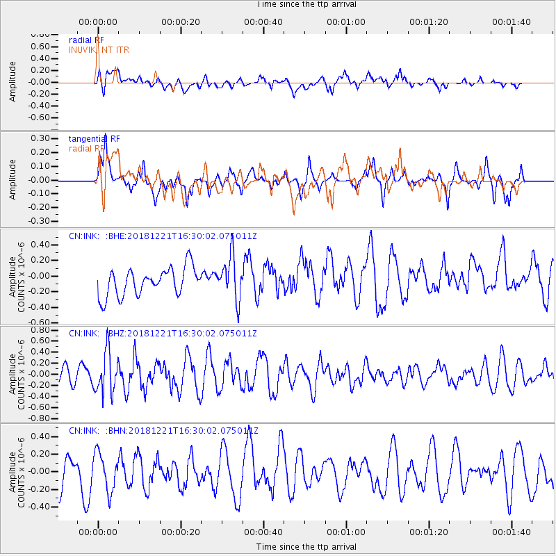
INK INUVIK, NT - Earthquake Result Viewer
*The percent match for this event was below the threshold and hence no stack was calculated.
| Earthquake location: |
Komandorskiye Ostrova Region |
| Earthquake latitude/longitude: |
54.8/164.8 |
| Earthquake time(UTC): |
2018/12/21 (355) 16:24:16 GMT |
| Earthquake Depth: |
10 km |
| Earthquake Magnitude: |
5.0 Mww |
| Earthquake Catalog/Contributor: |
NEIC PDE/us |
|
| Network: |
CN Canadian National Seismograph Network |
| Station: |
INK INUVIK, NT |
| Lat/Lon: |
68.31 N/133.53 W |
| Elevation: |
44 m |
|
| Distance: |
30.8 deg |
| Az: |
39.721 deg |
| Baz: |
275.355 deg |
| Ray Param: |
$rayparam |
*The percent match for this event was below the threshold and hence was not used in the summary stack. |
|
| Radial Match: |
52.7638 % |
| Radial Bump: |
400 |
| Transverse Match: |
56.17863 % |
| Transverse Bump: |
397 |
| SOD ConfigId: |
13570011 |
| Insert Time: |
2019-05-02 03:08:20.543 +0000 |
| GWidth: |
2.5 |
| Max Bumps: |
400 |
| Tol: |
0.001 |
|
Signal To Noise
| Channel | StoN | STA | LTA |
| CN:INK: :BHZ:20181221T16:30:02.075011Z | 1.9730839 | 3.7939125E-7 | 1.922834E-7 |
| CN:INK: :BHN:20181221T16:30:02.075011Z | 1.568063 | 2.1804361E-7 | 1.3905283E-7 |
| CN:INK: :BHE:20181221T16:30:02.075011Z | 1.6108103 | 2.8755744E-7 | 1.7851727E-7 |
| Arrivals |
| Ps | |
| PpPs | |
| PsPs/PpSs | |


