You are here: Home > Network List > TA - USArray Transportable Network (new EarthScope stations) Stations List
> Station M31M Drury Creek, Yukon, CA > Earthquake Result Viewer
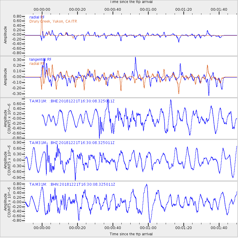
M31M Drury Creek, Yukon, CA - Earthquake Result Viewer
*The percent match for this event was below the threshold and hence no stack was calculated.
| Earthquake location: |
Komandorskiye Ostrova Region |
| Earthquake latitude/longitude: |
54.8/164.8 |
| Earthquake time(UTC): |
2018/12/21 (355) 16:24:16 GMT |
| Earthquake Depth: |
10 km |
| Earthquake Magnitude: |
5.0 Mww |
| Earthquake Catalog/Contributor: |
NEIC PDE/us |
|
| Network: |
TA USArray Transportable Network (new EarthScope stations) |
| Station: |
M31M Drury Creek, Yukon, CA |
| Lat/Lon: |
62.20 N/134.39 W |
| Elevation: |
639 m |
|
| Distance: |
31.5 deg |
| Az: |
51.527 deg |
| Baz: |
284.682 deg |
| Ray Param: |
$rayparam |
*The percent match for this event was below the threshold and hence was not used in the summary stack. |
|
| Radial Match: |
56.56745 % |
| Radial Bump: |
400 |
| Transverse Match: |
62.001083 % |
| Transverse Bump: |
349 |
| SOD ConfigId: |
13570011 |
| Insert Time: |
2019-05-02 03:13:05.502 +0000 |
| GWidth: |
2.5 |
| Max Bumps: |
400 |
| Tol: |
0.001 |
|
Signal To Noise
| Channel | StoN | STA | LTA |
| TA:M31M: :BHZ:20181221T16:30:08.325011Z | 1.8190047 | 3.8205843E-7 | 2.1003709E-7 |
| TA:M31M: :BHN:20181221T16:30:08.325011Z | 2.220112 | 4.2097722E-7 | 1.896198E-7 |
| TA:M31M: :BHE:20181221T16:30:08.325011Z | 1.6534729 | 3.5990948E-7 | 2.176688E-7 |
| Arrivals |
| Ps | |
| PpPs | |
| PsPs/PpSs | |


