You are here: Home > Network List > TJ - Tajikistan National Seismic Network Stations List
> Station GARM Garm, Tajikistan > Earthquake Result Viewer
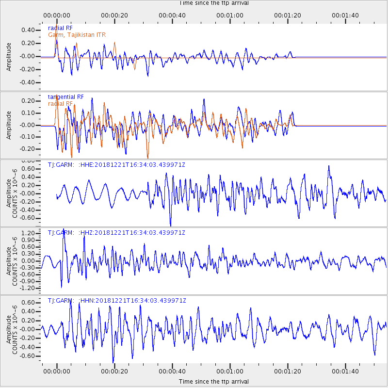
GARM Garm, Tajikistan - Earthquake Result Viewer
*The percent match for this event was below the threshold and hence no stack was calculated.
| Earthquake location: |
Komandorskiye Ostrova Region |
| Earthquake latitude/longitude: |
54.8/164.8 |
| Earthquake time(UTC): |
2018/12/21 (355) 16:24:16 GMT |
| Earthquake Depth: |
10 km |
| Earthquake Magnitude: |
5.0 Mww |
| Earthquake Catalog/Contributor: |
NEIC PDE/us |
|
| Network: |
TJ Tajikistan National Seismic Network |
| Station: |
GARM Garm, Tajikistan |
| Lat/Lon: |
39.00 N/70.32 E |
| Elevation: |
1305 m |
|
| Distance: |
61.6 deg |
| Az: |
297.992 deg |
| Baz: |
41.027 deg |
| Ray Param: |
$rayparam |
*The percent match for this event was below the threshold and hence was not used in the summary stack. |
|
| Radial Match: |
64.14207 % |
| Radial Bump: |
400 |
| Transverse Match: |
71.95587 % |
| Transverse Bump: |
400 |
| SOD ConfigId: |
13570011 |
| Insert Time: |
2019-05-02 03:13:22.909 +0000 |
| GWidth: |
2.5 |
| Max Bumps: |
400 |
| Tol: |
0.001 |
|
Signal To Noise
| Channel | StoN | STA | LTA |
| TJ:GARM: :HHZ:20181221T16:34:03.439971Z | 2.8046396 | 6.088221E-7 | 2.1707677E-7 |
| TJ:GARM: :HHN:20181221T16:34:03.439971Z | 2.615427 | 2.098476E-7 | 8.023454E-8 |
| TJ:GARM: :HHE:20181221T16:34:03.439971Z | 1.0745956 | 1.6622192E-7 | 1.5468324E-7 |
| Arrivals |
| Ps | |
| PpPs | |
| PsPs/PpSs | |


