You are here: Home > Network List > G - GEOSCOPE Stations List
> Station MPG Montagne des Peres, French Guyana > Earthquake Result Viewer
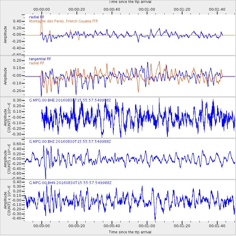
MPG Montagne des Peres, French Guyana - Earthquake Result Viewer
*The percent match for this event was below the threshold and hence no stack was calculated.
| Earthquake location: |
South Sandwich Islands Region |
| Earthquake latitude/longitude: |
-55.3/-30.4 |
| Earthquake time(UTC): |
2016/08/30 (243) 15:46:02 GMT |
| Earthquake Depth: |
10 km |
| Earthquake Magnitude: |
5.6 MB |
| Earthquake Catalog/Contributor: |
NEIC PDE/NEIC ALERT |
|
| Network: |
G GEOSCOPE |
| Station: |
MPG Montagne des Peres, French Guyana |
| Lat/Lon: |
5.11 N/52.64 W |
| Elevation: |
147 m |
|
| Distance: |
63.0 deg |
| Az: |
334.994 deg |
| Baz: |
165.961 deg |
| Ray Param: |
$rayparam |
*The percent match for this event was below the threshold and hence was not used in the summary stack. |
|
| Radial Match: |
57.111538 % |
| Radial Bump: |
400 |
| Transverse Match: |
58.525146 % |
| Transverse Bump: |
400 |
| SOD ConfigId: |
1634031 |
| Insert Time: |
2016-09-13 15:46:44.888 +0000 |
| GWidth: |
2.5 |
| Max Bumps: |
400 |
| Tol: |
0.001 |
|
Signal To Noise
| Channel | StoN | STA | LTA |
| G:MPG:00:BHZ:20160830T15:55:57.549988Z | 2.0725143 | 3.103442E-7 | 1.4974285E-7 |
| G:MPG:00:BHN:20160830T15:55:57.549988Z | 1.5841467 | 1.5509859E-7 | 9.7906714E-8 |
| G:MPG:00:BHE:20160830T15:55:57.549988Z | 1.2972053 | 1.4611915E-7 | 1.12641494E-7 |
| Arrivals |
| Ps | |
| PpPs | |
| PsPs/PpSs | |


