You are here: Home > Network List > TA - USArray Transportable Network (new EarthScope stations) Stations List
> Station N17A Moffit Pass, UT, USA > Earthquake Result Viewer
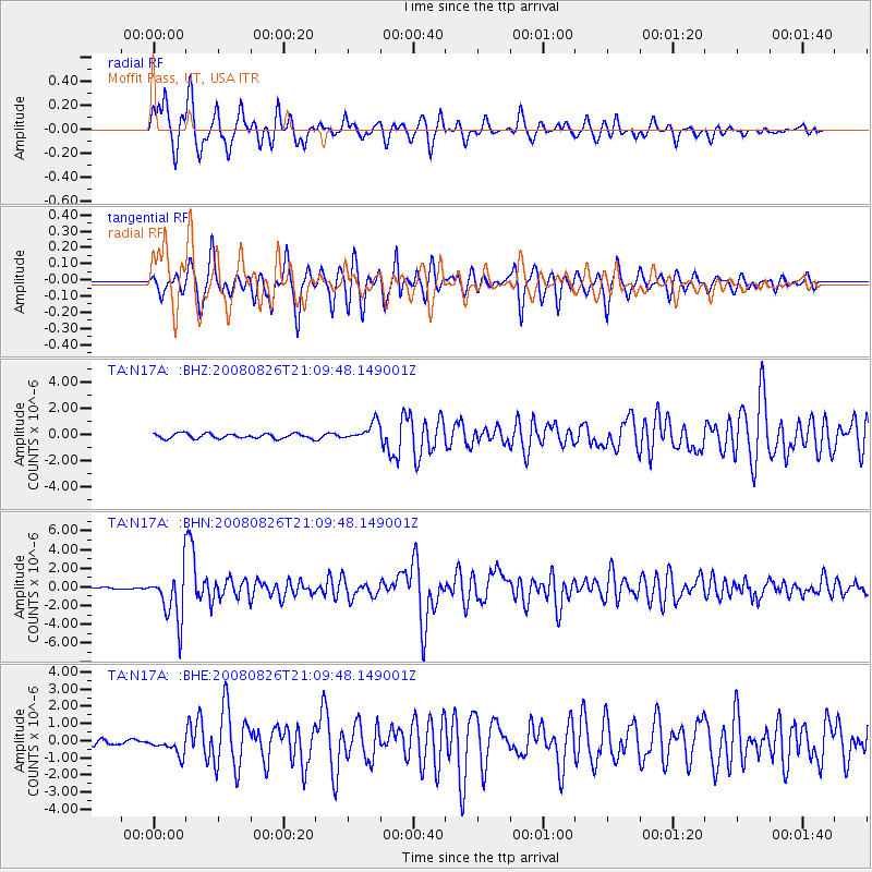
N17A Moffit Pass, UT, USA - Earthquake Result Viewer
*The percent match for this event was below the threshold and hence no stack was calculated.
| Earthquake location: |
Peru-Brazil Border Region |
| Earthquake latitude/longitude: |
-7.6/-74.4 |
| Earthquake time(UTC): |
2008/08/26 (239) 21:00:36 GMT |
| Earthquake Depth: |
154 km |
| Earthquake Magnitude: |
6.0 MB, 6.4 MW, 6.4 MW |
| Earthquake Catalog/Contributor: |
WHDF/NEIC |
|
| Network: |
TA USArray Transportable Network (new EarthScope stations) |
| Station: |
N17A Moffit Pass, UT, USA |
| Lat/Lon: |
40.94 N/110.83 W |
| Elevation: |
2500 m |
|
| Distance: |
58.8 deg |
| Az: |
328.255 deg |
| Baz: |
136.492 deg |
| Ray Param: |
$rayparam |
*The percent match for this event was below the threshold and hence was not used in the summary stack. |
|
| Radial Match: |
88.98688 % |
| Radial Bump: |
399 |
| Transverse Match: |
88.54248 % |
| Transverse Bump: |
391 |
| SOD ConfigId: |
2504 |
| Insert Time: |
2010-03-06 18:50:00.775 +0000 |
| GWidth: |
2.5 |
| Max Bumps: |
400 |
| Tol: |
0.001 |
|
Signal To Noise
| Channel | StoN | STA | LTA |
| TA:N17A: :BHN:20080826T21:09:48.149001Z | 30.704445 | 2.6908365E-6 | 8.763671E-8 |
| TA:N17A: :BHE:20080826T21:09:48.149001Z | 2.9373238 | 5.0516866E-7 | 1.7198262E-7 |
| TA:N17A: :BHZ:20080826T21:09:48.149001Z | 3.6706703 | 6.9606034E-7 | 1.896276E-7 |
| Arrivals |
| Ps | |
| PpPs | |
| PsPs/PpSs | |


