You are here: Home > Network List > TA - USArray Transportable Network (new EarthScope stations) Stations List
> Station N17A Moffit Pass, UT, USA > Earthquake Result Viewer
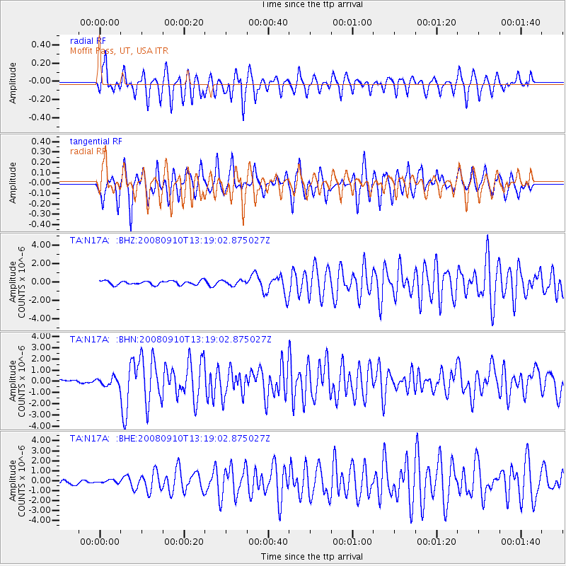
N17A Moffit Pass, UT, USA - Earthquake Result Viewer
*The percent match for this event was below the threshold and hence no stack was calculated.
| Earthquake location: |
Central Mid-Atlantic Ridge |
| Earthquake latitude/longitude: |
8.1/-38.7 |
| Earthquake time(UTC): |
2008/09/10 (254) 13:08:14 GMT |
| Earthquake Depth: |
10 km |
| Earthquake Magnitude: |
6.3 MB, 6.5 MS, 6.6 MW, 6.6 MW |
| Earthquake Catalog/Contributor: |
WHDF/NEIC |
|
| Network: |
TA USArray Transportable Network (new EarthScope stations) |
| Station: |
N17A Moffit Pass, UT, USA |
| Lat/Lon: |
40.94 N/110.83 W |
| Elevation: |
2500 m |
|
| Distance: |
71.2 deg |
| Az: |
310.413 deg |
| Baz: |
95.61 deg |
| Ray Param: |
$rayparam |
*The percent match for this event was below the threshold and hence was not used in the summary stack. |
|
| Radial Match: |
74.330986 % |
| Radial Bump: |
400 |
| Transverse Match: |
81.594444 % |
| Transverse Bump: |
400 |
| SOD ConfigId: |
2560 |
| Insert Time: |
2010-03-06 18:50:07.002 +0000 |
| GWidth: |
2.5 |
| Max Bumps: |
400 |
| Tol: |
0.001 |
|
Signal To Noise
| Channel | StoN | STA | LTA |
| TA:N17A: :BHN:20080910T13:19:02.875027Z | 2.25383 | 3.528243E-7 | 1.5654433E-7 |
| TA:N17A: :BHE:20080910T13:19:02.875027Z | 0.5596672 | 1.4383508E-7 | 2.5700106E-7 |
| TA:N17A: :BHZ:20080910T13:19:02.875027Z | 1.2198565 | 2.5556662E-7 | 2.0950549E-7 |
| Arrivals |
| Ps | |
| PpPs | |
| PsPs/PpSs | |


