You are here: Home > Network List > TA - USArray Transportable Network (new EarthScope stations) Stations List
> Station N17A Moffit Pass, UT, USA > Earthquake Result Viewer
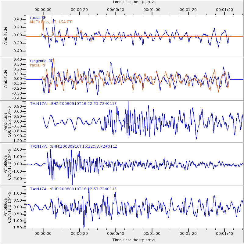
N17A Moffit Pass, UT, USA - Earthquake Result Viewer
*The percent match for this event was below the threshold and hence no stack was calculated.
| Earthquake location: |
Northern Chile |
| Earthquake latitude/longitude: |
-20.3/-69.2 |
| Earthquake time(UTC): |
2008/09/10 (254) 16:12:04 GMT |
| Earthquake Depth: |
38 km |
| Earthquake Magnitude: |
5.6 MB, 5.3 MS |
| Earthquake Catalog/Contributor: |
WHDF/NEIC |
|
| Network: |
TA USArray Transportable Network (new EarthScope stations) |
| Station: |
N17A Moffit Pass, UT, USA |
| Lat/Lon: |
40.94 N/110.83 W |
| Elevation: |
2500 m |
|
| Distance: |
72.1 deg |
| Az: |
328.091 deg |
| Baz: |
139.073 deg |
| Ray Param: |
$rayparam |
*The percent match for this event was below the threshold and hence was not used in the summary stack. |
|
| Radial Match: |
67.98687 % |
| Radial Bump: |
400 |
| Transverse Match: |
69.77077 % |
| Transverse Bump: |
400 |
| SOD ConfigId: |
2560 |
| Insert Time: |
2010-03-06 18:50:08.278 +0000 |
| GWidth: |
2.5 |
| Max Bumps: |
400 |
| Tol: |
0.001 |
|
Signal To Noise
| Channel | StoN | STA | LTA |
| TA:N17A: :BHN:20080910T16:22:53.724011Z | 6.6376066 | 7.3112176E-7 | 1.10148406E-7 |
| TA:N17A: :BHE:20080910T16:22:53.724011Z | 0.80917966 | 2.1538362E-7 | 2.6617528E-7 |
| TA:N17A: :BHZ:20080910T16:22:53.724011Z | 1.3428363 | 2.6655448E-7 | 1.985011E-7 |
| Arrivals |
| Ps | |
| PpPs | |
| PsPs/PpSs | |


