
E17A Martinsdale, MT, USA - Earthquake Result Viewer
| ||||||||||||||||||
| ||||||||||||||||||
| ||||||||||||||||||
|
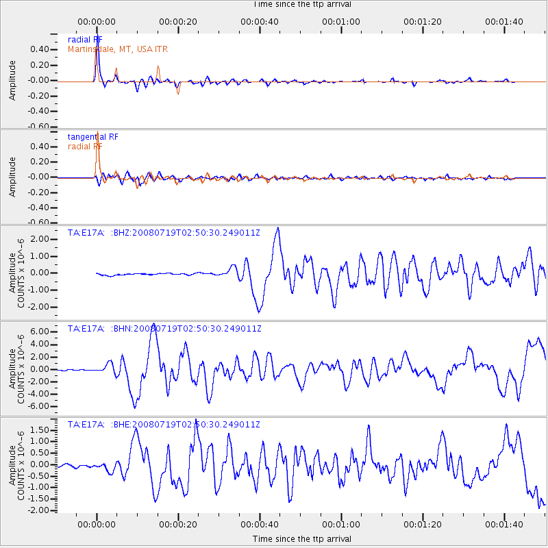
Signal To Noise
| Channel | StoN | STA | LTA |
| TA:E17A: :BHN:20080719T02:50:30.249011Z | 10.404228 | 8.0516617E-7 | 7.738836E-8 |
| TA:E17A: :BHE:20080719T02:50:30.249011Z | 3.3197505 | 1.884559E-7 | 5.676809E-8 |
| TA:E17A: :BHZ:20080719T02:50:30.249011Z | 5.6001687 | 2.7959499E-7 | 4.992617E-8 |
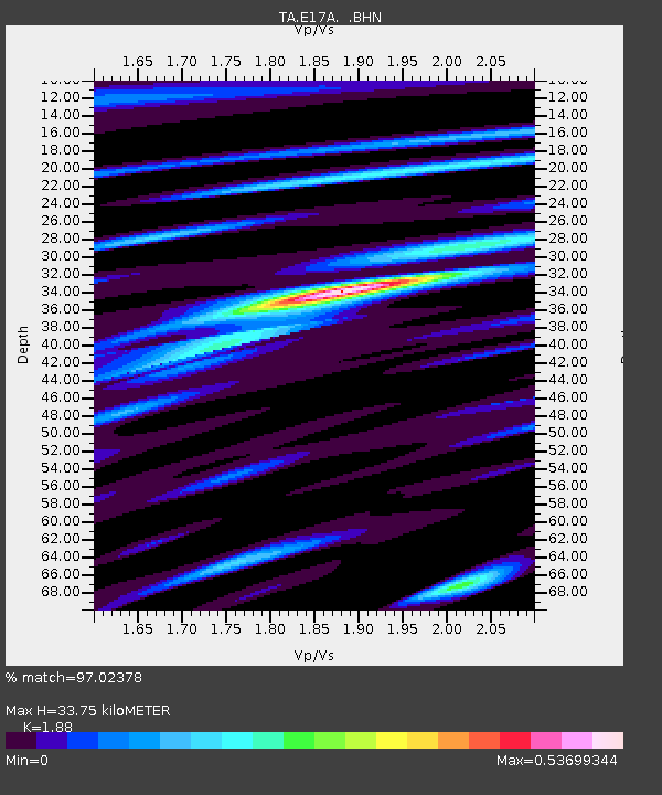
| Arrivals | |
| Ps | 4.9 SECOND |
| PpPs | 15 SECOND |
| PsPs/PpSs | 20 SECOND |

