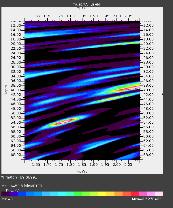
E17A Martinsdale, MT, USA - Earthquake Result Viewer
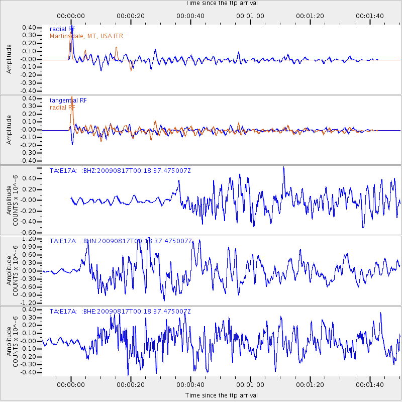
Earthquake location: Southwestern Ryukyu Isl., Japan
Earthquake latitude/longitude: 23.5/123.5
Earthquake time(UTC): 2009/08/17 (229) 00:05:49 GMT
Earthquake Depth: 20 km
Earthquake Magnitude: 6.2 MB, 6.6 MS, 6.7 MW, 6.6 MW
Earthquake Catalog/Contributor: WHDF/NEIC
Network: TA USArray Transportable Network (new EarthScope stations)
Station: E17A Martinsdale, MT, USA
Lat/Lon: 46.46 N/110.86 W
Elevation: 1835 m
Distance: 94.8 deg
Az: 34.313 deg
Baz: 311.527 deg
Ray Param: 0.040951956
Estimated Moho Depth: 53.5 km
Estimated Crust Vp/Vs: 1.77
Assumed Crust Vp: 6.306 km/s
Estimated Crust Vs: 3.563 km/s
Estimated Crust Poisson's Ratio: 0.27
Radial Match: 89.06991 %
Radial Bump: 400
Transverse Match: 82.81511 %
Transverse Bump: 400
SOD ConfigId: 2622
Insert Time: 2010-03-06 18:51:23.034 +0000
GWidth: 2.5
Max Bumps: 400
Tol: 0.001

Signal To Noise

ChannelStoNSTALTA
TA:E17A: :BHN:20090817T00:18:37.475007Z3.25120622.0978625E-76.452567E-8
TA:E17A: :BHE:20090817T00:18:37.475007Z1.82518144.9535448E-82.7140015E-8
TA:E17A: :BHZ:20090817T00:18:37.475007Z1.71256367.3768085E-84.3074653E-8
Arrivals
Ps6.7 SECOND
PpPs23 SECOND
PsPs/PpSs30 SECOND